[🇧🇩] Save the Rivers/Forests/Hills-----Save the Environment

[🇧🇩] Save the Rivers/Forests/Hills-----Save the Environment
558
17K
More threads by Saif

G Bangladesh Defense

35 years of the 1991 cyclone: a call for building coastal resilience

As a country there is no way we can prevent natural hazards like cyclones, flooding and sea level rise but we can reduce disaster risks by building our own resilience through adaptation measures, applying nature-based solutions and building buffer zones, effective community engagement, early warning systems, and necessary infrastructural development

Parvez Uddin Chowdhury
Published: 29 Apr 2026, 08: 10

1777507726034.webp

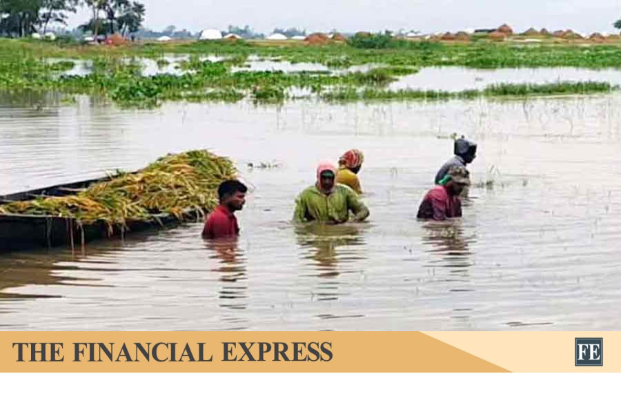
Cyclone causes large swaths of land in the coastal areas to go under water AFP

After long dry season, April is traditionally seen as a time of renewal of nature. Nature stirs back to life with the first rain. It is a new beginning that brings joy and hope to people and to every other creature in nature. But for the coastal people of southern Chattogram, April is not only a month of hope and celebration but also of fear – fear of devastating cyclones, violent storm surges and flooding.

TS Eliot called April ‘the cruelest month’ in his poem The Wasteland. His description deeply resonates with the people who survived the catastrophic 1991 cyclone that struck the southeastern coastal belt of Bangladesh.

Today marks the 35th anniversary of the 1991 cyclone. It was one of the most powerful cyclones ever recorded in history that killed over 140,000 people including more than 40,000 from Banshkhali alone. Though all the coastal areas were affected, the majority of the fatalities occurred in the southeastern coastal belt that includes Banshkhali, Anowara, Chakaria, Pekua, Kutubdia and Moheskhali. In addition to the immense human toll, the cyclone left over 10 million people homeless across the belt. Overall property and infrastructure damage was in billions of dollars.

People living along the coast are often considered to be naturally brave and resilient as they survive facing the harsh behavior of the sea. For them, cyclones and flooding are not rare incidents. Yet for those who endured the 1991 cyclone, resilience does not mean fearlessness. The trauma of that night is still alive, and many who survived say they would not wish to confront such a calamity again. Coastal people in southern Chattogram still continue to bear the haunting memories of that disastrous cyclone. Decades later, the disaster remains a powerful collective memory for the people of the entire coastal belt.

I was born in a seaside village in Banshkhali, Chattogram. We suffered the loss of many family members, and all our properties were lost during the cyclone. My father often recalls the haunting memories of that powerful cyclone. It made landfall at night with storm surges as tall as a two-storey building that flooded the entire coastal villages within seconds. The whole night was horrific with salty rain and violent wind. There were no cyclone shelters at that time and also no effective early warning system. Like many others, my father survived holding the floating roof of our thatched house and my mother survived clinging to a tree.

Every year thousands of people are being displaced, losing livelihoods in the coastal areas due to various climate effects. Reports are often seen that mangroves along the coastline are being erased for shrimp projects and salt-producing fields leaving people without adequate natural protection.

My father says the aftermath was even more catastrophic. Much of the water had receded by the morning. Everything was swept away; the entire coastline became unfamiliar. Those who survived started looking for the missing family members. Searching was difficult as there was no visible road, on top of that, people were hungry, had nothing to eat. There were dead bodies floating everywhere face lying down. After few days, army personnel arrived and started burying dead bodies and people got some dry food being dropped from helicopters.

My parents live in the village. They still get terrified when a cyclone alert is issued in April and May. My mother repeatedly calls me to ask how far my home is from the sea and urges me to seek shelter on high ground. Her concern may sound excessive or even awkward to me, but she speaks from lived experience—and she means it with absolute seriousness.

Building coastal resilience

Powerful cyclones hitting the coastal belts along the Bay of Bengal is not new. Due to various geographical factors, the Bay of Bengal is often called a hotbed for powerful tropical cyclones. Majority of the deadliest tropical cyclones in world history occurred here. According to a report by Weather Underground, 26 of the 35 deadliest tropical cyclones in recorded history have occurred in the Bay.

Because of global warming and sea level rise, scientists say intensity of cyclones is increasing. Every year there are a lot of research, reports and newspaper articles consistently being published highlighting the diverse climate related challenges being faced by the coastal people and calling for urgent action.

It is not unknown to us that sea level in the Bay of Bengal is rising faster than global average. And on top of that, recent reports reveal that sea level in the eastern coast is rising faster than the western coast. So, coastal lowlands in Chattogram and people living along the belt are at greater risk of being affected.

Every year thousands of people are being displaced, losing livelihoods in the coastal areas due to various climate effects. Reports are often seen that mangroves along the coastline are being erased for shrimp projects and salt-producing fields leaving people without adequate natural protection.

Along Banshkhali coastal belt, since 2005, we have seen dramatic changes including powerful tidal flooding, breaking of embankments, uprooting of trees, erosion of coastal land, displacement of people, high salinity in the rice fields and so on. Many elderly people say they have not witnessed such turbulence in the bay''s waters in the last 100 years.

Banshkhali being an outlying upazila has often been overlooked and remained out of focus, particularly its western coastal villages. There are places with broken and poor embankments. Monsoon is approaching bringing with it worry and anxiety.

Every year, climate effects along the coastal belt are increasing and reminding us of the need to build more coastal resilience. Traditional hard solutions such as concrete seawalls, embankments reinforced with concrete blocks, or geo-bags, on their own, are insufficient to provide long-term protection. These measures need to be complemented by nature-based measures, including the restoration of mangroves, saltmarshes, and other coastal ecosystems that work as buffer zones. In some parts of Banshkhali shoreline, mangroves and saltmarshes are making significant changes in restoring coastal ecosystems which can be studied and applied in other places.

We have to remember that our coastlines are inherently very dynamic and diverse. One can visit Banshkhali shoreline to observe that clearly. Because of this variability, coastal interventions must be grounded in location-specific research. Blanket policies have already proven ineffective.

As a country there is no way we can prevent natural hazards like cyclones, flooding and sea level rise but we can reduce disaster risks by building our own resilience through adaptation measures, applying nature-based solutions and building buffer zones, effective community engagement, early warning systems, and necessary infrastructural development.

* Parvez Uddin Chowdhury is a development worker and climate enthusiast.​
 

State minister terms waterlogging reports on Chattogram city baseless

Staff Correspondent
Dhaka
Published: 30 Apr 2026, 22: 33

1777595052836.webp

Local Government State Minister Mir Shahe Alam inspects Probortok Mor, one of the long-suffering spots of waterlogging in Chattogram city, on 29 April 2026. Prothom Alo

Local Government State Minister Mir Shahe Alam has claimed that there was no waterlogging in Chattogram Metropolitan City during the rainfall, describing reports of waterlogging as completely baseless, fabricated, and imaginary.

He said propaganda had been spread using images from 2024. According to him, there was waterlogging at five locations.

He made these remarks today, Thursday, in a statement under Rule 300 in the parliament.

It is to mention that on 28 April, heavy rainfall submerged various parts of Chattogram city. The issue was raised in the parliament last Wednesday as a “point of order” by BNP lawmaker Saeed Al Noman. Later, Prime Minister Tarek Rahman apologised to the residents of Chattogram and assured that the problem would be resolved.

In his statement in Parliament today, Thursday, State Minister Shahe Alam said that a narrative had emerged claiming that Chattogram city was floating on water. This was widely circulated on social media.

The Prime Minister had apologised to the people of Chattogram during the question-answer session in Parliament regarding this matter.

Following the Prime Minister’s directive, he visited Chattogram on Wednesday to inspect the situation on the ground and toured the city until Thursday afternoon.

The state minister said, “The matter is completely baseless, fabricated, and imaginary. Propaganda has been spread using images from 2024. Based on a report or a statement from one of our Members of Parliament, he (the Prime Minister) ended up apologising. However, I occasionally went out on the streets and spoke with ordinary people. They said they were happy and pleased that the Prime Minister had apologised to the residents of Chattogram. Through this, the Prime Minister has shown great generosity. The city residents have taken it very positively. They said that compared to one or two years ago, the level of waterlogging has now decreased.”

Mir Shahe Alam said that there are a total of 57 canals in Chattogram city. Of these, development work on 36 canals is being implemented by the Bangladesh Army at a cost of Tk 120 billion through the Chattogram Development Authority. Work on 30 canals has already been completed, while work on six is ongoing.

The state minister said that during the implementation of this work, embankments had been constructed in some areas.

Due to sudden heavy rainfall, those embankments caused waterlogging. On that day, Chattogram received 220 millimetres of rainfall.

As a result, waterlogging—not waterlogging—occurred at five places, including Probortok Mor. The water was drained within three to four hours through joint efforts. Today, there is no water in Chattogram.​
 

Enhancing resilience in time of climate uncertainty

FE
Published :
May 04, 2026 00:25
Updated :
May 04, 2026 00:25

1777851848135.webp


The current wave of heavy rain and flash floods has ravaged vast tracts of cropland across haor areas of Sunamganj, Sylhet, Netrakona and Kishoreganj. Thousands of farmers, mostly smallholders, fear huge financial losses, as heavy rain and onrush of water from upstream have gulped their ripe paddy just before harvest. Though it is too early for a full assessment of the damage to crops, initial reports suggest farmers' losses stand by now at billions of taka. As per government estimates, 7,000 hectares of cropland have been inundated, while farmers claim that nearly half of their crops have been destroyed. With pre-monsoon torrential rains continuing, more agricultural land is likely to be swallowed by the floods in the coming days. Climate change is intensifying the frequency and severity of flash floods, making the subsequent crop losses a recurring annual phenomenon. So, the question is, why does preparedness remain so inadequate in the face of a disaster that is both seasonal and predictable?

The agricultural losses will weigh heavily on both the economy and the people. The haor regions account for around one-fifth of the country's annual rice production, while nearly 60 per cent of total output comes from the Boro season. For farmers in these areas, Boro cultivation is the principal source of income. When crops are washed away just before harvest, the impact extends far beyond immediate crop loss. It jeopardises the food security of the farming families in haor regions for the entire year, undermines their ability to repay loans and fuels food inflation. The rice price hike followed by crop devastation during the floods of 2017 and 2022 offers a disquieting reminder of the broader economic and social consequences. More people are likely to slip below the poverty line, while the increase in prices of essential foods will disproportionately affect low-income people.

Regrettably, in the face of increasingly erratic climatic condition, national preparedness remains inadequate. Farmers are either not informed about weather forecasts or are unable to harvest their crops in time due to labour shortages and rising costs. Combined harvesters are crucial for reaping crops across the vast haor areas within a narrow window. But the recent hike in diesel prices made their operation expensive. Moreover, poor field conditions often prevent their effective use. Against this backdrop, the responsibility of local authorities cannot end with issuing warnings and urging farmers to act swiftly. A more proactive approach is needed to ensure availability and affordability of combined harvesters, along with mobilisation of labour before impending floods. Meanwhile, there are numerous allegations regarding the construction and timely repair of embankments. Although the government allocates substantial funds each year for haor protection, substandard earthwork, mismanagement of resources and syndicate influence remain persistent concerns. At a recent gathering in Sunamganj, farmers put forward 10-point demands, including compensation for flood-affected farmers, loan waivers and a judicial probe into irregularities. The authorities must address these issues with sincerity and urgency.

The government has already promised three months' aid for affected farmers, which is welcome. However, their other demands also warrant consideration. In the longer term, priority should be given to building climate-resilient infrastructure, strengthening early warning systems and developing robust agricultural resilient mechanisms, including crop insurance. Without such sustained and coordinated efforts, each new flood will continue to destroy crops, devastate livelihoods and pose a growing threat to national food security.​
 

The overlooked crisis of climate displacement in Bangladesh

Paramita Bhattacharyya
Published: 05 May 2026, 08: 14

1777947421449.webp

Fighting against climate change in Bangladesh.Logic/UNDP

If one were to ask people today what “Internally Displaced Persons” (IDPs) means, many would struggle to answer. Because this term has remained largely unfamiliar outside academia and policy circles, despite being a real urgent crisis. At a time when global attention is fixed on geopolitical tensions particularly the escalating conflict between the United States and Iran, and the resulting energy and economic instability, another crisis is quietly being ignored. Climate-induced internal displacement, a crucial phenomenon in countries like Bangladesh, is being overshadowed precisely when it demands urgent attention.

1777947488038.webp

A girl carries drinking water in a bucket from a nearby deep tube-well in Srifaltala Adarsha village in Rampal, Bagerhat as salinity rises in river and other water bodies in the area during dry season.Injamamul Haque.

Over the past decade, natural disasters have displaced an average of approximately 110,000 people each year in Bangladesh, according to the Internal Displacement Monitoring Centre (IDMC). This is not an isolated statistic, it reflects the lived experiences of families forced to leave their homes due to climate induced problems such as cyclones, flooding, river erosion, and salinity intrusion. Coastal districts such as Satkhira and Bagerhat are particularly vulnerable, but the consequences persist beyond these regions.

Major urban centres, including Dhaka and Khulna, face increasing pressure as displaced populations migrate to these areas in search of livelihood, shelter, and security. The result is a cycle of vulnerability that stretches from the rural coastlines to the already overburdened cities.

Internal displacement differs from cross-border migration in one crucial respect, the IDPs remain within their own country. Yet this does not make their situation any less significant. In many cases, it accelerates their vulnerability. Displaced individuals often lose access to land, employment, and social networks, while also facing inadequate housing, limited access to healthcare, and heightened exposure to exploitation. Besides, IDPs do not benefit from a comprehensive international protection regime. Their protection depends largely on national frameworks, which is really insufficient in nature.

Without adequate planning and support systems, increased displacement could place unsustainable pressure on urban infrastructure and undermine long-term development goals.

In Bangladesh, climate-induced displacement is driven by a complex interconnection of environmental and socio-economic factors. Rising sea levels contribute to salinity intrusion, making agricultural lands unusable. Cyclones and storm surges destroy homes and infrastructure. Then comes riverbank erosion, a persistent problem, gradually grasping entire communities. Then these environmental issues are being compounded by poverty, population density, and limited adaptive capacity, which makes displacement not just a possibility but, for many, inevitable.

Despite the scale and urgency of the issue, Bangladesh’s legal and policy response remains insufficient and fragmented. The country has made commendable progress in areas such as disaster risk reduction and climate adaptation. However, there is no comprehensive legal framework that explicitly recognizes and addresses climate-induced internal displacement.

Existing policies often approach the issue indirectly, focusing on disaster management rather than long-term displacement and resettlement. Implementation gaps further weaken these efforts. Institutional coordination is limited, and the absence of clear mandates leads to overlapping responsibilities and inefficiencies.

The urgency of this issue is further heightened by the current instability in the global economic landscape. Ongoing geopolitical tensions, including the United States-Iran conflict, have contributed to rising energy prices, inflation, and notable disruptions in global supply chains. For a country like Bangladesh, which is already grappling with a lot of issues, these economic pressures significantly constrain the capacity to respond to the plight of the internally displaced persons effectively. Increased costs of food, fuel, and basic services disproportionately affect vulnerable populations, including those already displaced or at risk of displacement.

In this context, climate-induced internal displacement is no longer just an environmental or humanitarian concern anymore. It has emerged as an economic crisis. As global resources are diverted towards conflict management and consequences, issues like internal displacement risks are being less prioritized. And the harsh reality is, consequences of inaction are likely to be severe. Without adequate planning and support systems, increased displacement could place unsustainable pressure on urban infrastructure and undermine long-term development goals.

This year, the convergence of climate risks and global economic instability may make the situation particularly acute. If the existing situation continues, Bangladesh could face not only higher rates of displacement but also reduced capacity to respond. This makes it imperative for policymakers to act proactively. Establishing legal recognition of climate-induced displacement, investing in resilient infrastructure and developing international cooperation are essential steps now.

Bangladesh has often been recognised as a leader in climate adaptation. It now has an opportunity to extend that leadership by addressing one of the most pressing yet overlooked dimensions of the climate crisis. It is no more an academic discussion in Bangladesh. It has become a real horror. So now the question is no longer whether this crisis exists, but whether we are willing to confront it before it deepens further.

* Paramita Bhattacharyya is a student at Kobe University, Japan.​
 

Can Dhaka regain its lost biodiversity before it's too late?

Shafiq R Bhuiyan

Published :
May 07, 2026 00:36
Updated :
May 07, 2026 00:36

1778111742511.webp


Dhaka's greatest crisis is not just pollution or falling water tables, but a rapid loss of biodiversity that threatens the city's capacity to support life. Reversing this decline must be the city's most urgent priority if it is to secure a liveable future for its people.

The Prime Minister's 12-point plan for a clean and green city is a good start. However, real recovery means changing past policies and making biodiversity central to every future decision.

Since 1990, Dhaka has lost more than 70 per cent of its wetlands to unplanned development. This loss has left the city more vulnerable to floods and extreme heat. In 2000, the Detailed Area Plan made things worse by rezoning much of this land, removing important natural protection. Rivers became dumping grounds, trees were cut down and floodplains disappeared beneath new buildings. These choices have added up, leaving the city dangerously exposed to disaster.

Restoring Dhaka's biodiversity is not just important-it is the foundation for the city's survival. Every urban decision, from infrastructure to management, must first prioritise water and green spaces to revive nature and secure the future.

Dhaka was once built around water and green spaces. The Buriganga, Turag, Balu and Shitalakkhya rivers helped control temperature and flooding. Wetlands, canals and trees soaked up monsoon rains and kept the city cool. Biodiversity was a key part of the city's infrastructure.

Now, even regular rainfall can cause floods in Dhaka, and heatwaves can be deadly. Filling wetlands, blocking canals and cutting down trees have made the city hotter and weaker. Air-conditioned buildings add to the heat. Fireflies, frogs and common birds like crows have almost vanished, though thousands of Black Kites remain.

Biodiversity loss threatens the environment, economy and public health. Recovery requires active community involvement and must guide city planning beyond surface-level solutions like tree planting or cleanliness drives.

First, we must protect wetlands as vital ecological resources andupdate the Detailed Area Plan to ensure the retention of ponds and floodplains. Once lost, ecosystems cannot be fully restored. Prevention is more effective and affordable than artificial drainage.

Second, we must enforce waste and land use rules to revive rivers. The government must make river restoration a top priority.

Third, urban forestry must do more than beautify. Unplanned tree planting, poor soil prep and lack of care are ineffective. Dhaka needs native trees, green corridors and tree-coverage requirements for new buildings. Biodiversity must be connected, rather than remain scattered.

Fourth, we need robust environmental impact reviews for every project. If mature trees are removed during road expansion or construction, developers must implement a detailed, time-bound compensatory plan. Any loss of permeable surface should be offset by funded restoration elsewhere. Economic decisions must fully account for environmental costs.

Finally, Dhaka needs a single strong ecological coordination unit with real authority to enforce rules. Right now, responsibilities are split among the city corporations, RAJUK, WASA and other ministries, leading to scattered efforts. This new unit should integrate planning, drainage, housing and transport into a single environmental plan to effectively protect biodiversity.

Some argue that a crowded city like Dhaka cannot focus on biodiversity. In reality, ignoring it results in higher energy and health costs, lower productivity and worse pollution. According to a World Bank report, Bangladesh lost USD 1.78 billion in 2024 due to heat-related health problems and reduced productivity, equivalent to 0.4% of GDP, as rising temperatures trigger widespread physical and mental health issues. Losing biodiversity compounds these problems.

There is also a social justice aspect to this issue. Environmental damage does not affect everyone equally. People in informal settlements suffer most during floods, and low-income communities have less access to green spaces. When wetlands disappear, people experiencing poverty often lose both their livelihoods and their protection.

Restoring biodiversity does not mean stopping urban growth. It means redesigning the city. Cities around the world are bringing back rivers, reopening old canals and growing urban forests-not just for looks, but to become stronger. Dhaka can learn from these examples and adapt them to its own needs.

Every filled wetland, polluted canal or lost mature tree raises Dhaka's risk of disaster. The longer we wait, the higher the cost of doing nothing. We often talk about GDP growth, big projects and changing skylines as signs of progress. But a city's real strength is found under the concrete: in soil that soaks up water, wetlands that protect against storms, trees that cool neighbourhoods and rivers that flow freely.

The city lost its biodiversity because of specific policies. The only way to reverse this crisis is to make every future policy and decision explicitly protect and restore nature's role in the city.

Dhaka's future depends on regaining its biodiversity. This requires direct action from everyone: advocating for and enforcing strong policies, participating in local restoration and holding leaders accountable at every level.​
 

Why do rivers die
Gawher Nayeem Wahra

Updated: 13 May 2026, 14: 07

1778716522271.webp


In this country, anyone can purchase land along a riverbank and construct virtually any kind of structure there.File photo

Why do rivers die? Rabindranath Tagore gave a simple yet profound scientific answer to this question. He wrote that rivers (streams of water) die when attempts are made to tightly control and possess them through embankments and domination.

Now scientists are beginning to say, “Living with rivers is more sustainable than trying to dominate them.” In other words, coexisting with rivers is more sustainable than trying to control them.

But to me, this seems to suggest not just coexistence, but a kind of submission to the river—accepting its dominance.

In Bangladesh, in a 2019 ruling, the High Court declared all rivers, including the Turag, as “living entities.” This means rivers have legal rights and protections similar to those of humans.

According to this ruling, occupying or polluting rivers is legally punishable like an attack on humans, and rivers can, in principle, seek legal redress through the courts.

The interpretation of “living entity” states that a river does not mean only the flowing water; it includes its banks, bed, and entire ecosystem. A river is considered a living being capable of feeling in a metaphorical legal sense and has its own right to flow.

If that right is violated, the court is expected to stand on the river’s side. Protection is to be ensured against occupation or destruction of rivers. In essence, actions such as river encroachment or heavy pollution, including industrial waste dumping, can be legally challenged.

Yet despite all this, people involved with river management still do not treat rivers as they should. Environmentalists and river advocates call this mentality “hubris.” In ancient Greece, hubris did not simply mean pride; it referred to extreme arrogance or excessive confidence that leads a person to defy moral law, social norms, and even the gods.

Recently, agricultural entrepreneur Delwar Jahan from Manikganj shared photos on Facebook showing concrete embankment construction along the Kaliganga River and called for an end to such anti-river activities.

He wrote that riverbanks are rich in biodiversity, home to various plants and habitats formed by seeds carried from different places. In river ecology, riverbanks are important transition zones between land and water, known as ecotones, which are among the most biodiverse areas. He argued that covering these areas with concrete or blocks is a serious ecological violation that blocks plant growth and natural expansion.

He also questioned where the people behind such embankment concreting come from. His question carries both frustration and irony. In response, someone wrote that such actions come from a “hubris-affected mindset” driven by so-called engineers attempting to showcase disruptive river-control technologies.

One may ask: why is there a need to concrete the banks of a calm river in Manikganj? Field observation shows that on the opposite bank, a privately owned industrial facility had already begun embankment protection work.

Once one bank is hardened, pressure shifts to the opposite bank, causing erosion there as well. Since anyone can establish industrial facilities after purchasing riverside land, the question arises: do they have the authority to control river management?

In Bangladesh, everyone seems to act as a guardian of rivers, yet there is no effective custodian. Across Panchagarh’s Dahuk, Sirajganj’s Jamuna, Pakshi’s Padma and the Gorai, embankment concreting continues unchecked.

Engineers are not necessarily “hubristic”

We know the name of Indian engineer GD Agarwal. He died on 11 October 2018 after an 111-day hunger strike demanding the uninterrupted flow and ecological integrity of rivers. After graduating in civil engineering from Roorkee University in 1952, he joined government service.

Later, as the first member secretary of India’s Central Pollution Control Board, he realised how administrative complexity and lack of political will were destroying rivers and the environment.

Through his scientific understanding, he concluded that a river is not merely a water channel. He demonstrated that flowing rivers contain a special type of virus called bacteriophages, which destroy harmful bacteria and help maintain water purity.

When rivers are blocked and made stagnant through embankments, these viruses die, and the river’s natural self-purifying capacity is destroyed.

He understood that river protection cannot be achieved only through laboratory work or academic writing; it requires mass awareness and moral pressure on governments. From his experience, he observed how more than 450 small and large dams were planned on the Ganga alone, fundamentally altering the river’s upper ecosystem.

His struggle for the Ganga began in 2008. Under pressure from his fast, the Uttarakhand government was forced to cancel major hydropower projects such as Loharinag Pala and Pala Maneri on the Bhagirathi River. Reports suggest that as a result of his movement, about 135 kilometers from the Bhagirathi’s source to Uttarkashi were declared an eco-sensitive zone.

Are there alternative ways to protect riverbanks?

We may not have a GD Agarwal, but many are searching for alternatives to protect riverbanks without killing rivers. In Bangladesh, due to strong currents, floods, and seasonal variations, riverbank erosion is a major problem. Traditional concrete or stone embankments are often expensive and environmentally harmful.

In contrast, vetiver grass is a deep-rooted plant that stabilises soil naturally and provides a long-term sustainable solution. Vetiver-based riverbank protection is no longer just a theoretical idea; it has been successfully implemented in countries such as India, Thailand, Vietnam, and Fiji, proving its effectiveness as a sustainable method.

In the Sundarbans region of West Bengal, vetiver grass is being used to address repeated embankment failures. In one pilot project, around 3,350 vetiver plants were planted along a 200-metre embankment, significantly reducing soil erosion and increasing stability.

Expansion on a larger scale is now being planned locally.

Riverbank protection measures should ensure that natural river flow is maintained, biodiversity is not harmed, and long-term sustainable solutions are achieved.

* Gawher Nayeem Wahra Writer and researcher​
 

Community-managed forests flourish amid hill deforestation in CHT

Partha Shankar Saha from the Chittagong Hill Tracts

Published: 14 May 2026, 12: 58

1778890169760.webp

Chittagong Hill Tracts Prothom Alo File photo

On a morning in late Chaitra, we arrived at Beganachhari village. The heat of the morning sun had already crept up. After crossing a stretch of flat paddy fields and moving closer to the forest, a cool breeze welcomed us. Dense trees and bamboo groves almost completely hid the sky. Bamboo leaves swayed in the wind. The call of birds and the familiar sound of lizards reached our ears. Large stones made the paths difficult to traverse. Even in this dry season, moss had formed on the stones due to the constant flow of a stream.

Human footprints were clearly visible on the stones. Inexperienced feet would occasionally slip on this path, but Kaloboron Chakma and Mamata Rani Chakma walked with ease. For them, this path was familiar. Likewise, the flowing stream of Beganachhari is nothing unusual for them even in this dry season. Yet, in nearby Shubhalong waterfall—one of the major tourist attractions—there was not a drop of water. We also saw disappointed faces of tourists. How can Beganachhari maintain its flow when Shubhalong, only 10 kilometers away, is dry?

From our forest journey companion, jhum cultivator Kalpa Ranjan Chakma, we learned that the water of this stream comes from the hill forests. The nearly seventy-year-old Kalpa Ranjan said, “I have never seen Beganachhari without water. There is water because there is forest. Tree roots retain water.”

From Rangamati town in the hill district, one must cross Kaptai Lake and the old Karnaphuli River to reach this riverside village of Barkal upazila—Beganachhari. Here lies a different kind of forest, closely connected with the stream. Forest, stream, and the nearly hundred households dependent on them—Beganachhari is a unique interaction among these three elements.

Such “different kinds” of forests exist in the Chittagong Hill Tracts by the hundreds. They are known by various names: village forests, mouza reserved forests, reserved areas, VCFs (Village Common Forests). These forests are found across all three hill districts—Rangamati, Khagrachhari, and Bandarban.

The forests of the Chittagong Hill Tracts

RH Sneyd Hutchinson, a former British administrator of the Chittagong Hill Tracts, once gave a remarkable description of the region’s forests. Describing its natural beauty, he wrote:

“The scenery throughout the district is very picturesque, the mixture of hill and valley, densely covered with forest and luxurious vegetation, yields the most beautiful and varied effects of light and shade. To be viewed at the best it should be seen from the summits of the main ranges, where the apparently boundless sea of forest is grand in the extreme. The cultivated areas of the valleys, dotted here and there, appear as islands, carpeted with emerald green, cloth of gold, or sober brown according to the season of the year. The rivers slowly meandering on their way to the sea, now shimmering like liquid gold, and again reflecting in heavy dark shadows every object within reach, all combine to make a picture not easily forgotten.”

Today’s nearly destroyed forests of the Chittagong Hill Tracts and its barren hills bear little resemblance to that century-old description. Yet there was a time when these forests were under the control of hill communities. These forest-dependent people did not distinguish between different categories of forest. But after British rule was established in the hills, the Chittagong Hill Tracts district was created in 1860, and forest division began. In 1871, the entire hill forest was declared “government forest land.” Different categories of forest were then created. The total area of the Chittagong Hill Tracts is 5,093 square miles. Of this, 1,244 square miles—about 24 per cent—are reserved forests where public access is restricted. There are also more than 54 square kilometers of protected forests under the Forest Department. In addition, there are more than 3,800 square kilometers of unclassified forest land.

VCFs and their history

VCF or mouza forest is a forest system entirely controlled by local communities. It belongs neither to individuals nor to the government. The entire village collectively uses and conserves this resource. Before state control over forests in the hills, there was no clear distinction between forest land, jhum cultivation land, or homesteads.

But when such divisions were introduced into the vast hill forests, local people began protecting mouza forests or VCFs out of necessity, according to Chakma Circle Chief Raja Debashish Roy. He told Prothom Alo that practices of VCF conservation vary among different ethnic groups in the Chittagong Hill Tracts and have done so historically as well.

Therefore, it is not accurate to say that VCFs originated in a specific year. After British authorities imposed control over forests, forest-dependent people intensified their efforts to protect their resources and began managing mouza forests or VCFs. Later, due to population growth and depletion of natural resources, some level of obligation to conserve mouza forests emerged even during the colonial period.

During British rule, these mouza forests or village forests were placed under the management of local headmen. This system was given legal recognition in the Chittagong Hill Tracts Regulation of 1900.

Land administration in the Chittagong Hill Tracts differs from other parts of Bangladesh. Here, three circle chiefs collect land revenue on behalf of the government: the Chakma Circle (Rangamati), the Bomang Circle (Bandarban), and the Mong Circle (Khagrachhari). Under these circle chiefs, mouza headmen operate. Several villages or paras together form a mouza. Under headmen, there are also karbaris at the village level. In some areas, VCF leadership is now also under karbaris. In others, both headmen and karbaris are supported by other local leaders. Women are also increasingly involved in this management system. Regardless of who leads—headmen, karbaris, or others—the ownership of the forest does not belong to any individual.

Forest management in VCFs

Every one of the 11 ethnic communities in the Chittagong Hill Tracts practices some form of village- or mouza-based forest system. The Chakmas call it Rizab or Service; the Marma call it Riza; and the Bawm call it Kuya Rizab. Despite differences in language, these forests are known by different names, but their management systems are largely similar. That management is quite strict.

Jhum cultivation is not allowed at the main water sources within the forest. Nothing that could damage water sources is permitted. Committees are responsible for monitoring to ensure that fire from jhum fields does not enter the mouza forest. All village members maintain regular vigilance over areas in the mouza forest where illegal cutting of bamboo or trees may occur. Harvesting plants or aquatic resources such as shrimp, fish, crabs, snails, etc., requires caution. During flowering and fruiting seasons, or breeding periods of aquatic species, harvesting is suspended for two to three months.

It is not that forest resources cannot be used at all. Kaloboron Chakma of Beganachhari says that if someone needs wood or bamboo to build a house or for other purposes, they can cut it with permission from the committee.

“If there is no forest, we do not exist”

Beganachhari has no national electricity supply. The villagers rely on solar power. There is also a “natural AC.” The source of this cooling system is the diverse tree species in Beganachhari’s forest and the streams flowing down from the hills.

Mamata Rani Chakma points to a tree and says, “This is Chakka Chhola.” This plant is used for stomach pain. Kalpa Ranjan Chakma said he benefited from its sap about two months ago. There are no pharmacies in this village, nor in nearby areas. For forest-dependent people, this forest is not only a source of medicine but also of food.

Beganachhari covers only 300 acres. The villagers we spoke to do not know how many species of trees exist in this forest. They only know that the forest is deeply connected to their lives. Mamata Rani Chakma says, “If there is no forest, we do not exist.”

Government forests decline, VCFs survive

People living around VCFs often have no formal education and do not know how many species of plants or animals exist in the forest. Yet their traditional knowledge and management systems have sustained these forests for centuries. Research on VCFs has revealed remarkable biodiversity.

One such study was conducted by Professor Khaled Mizbahuzzaman of the Institute of Forestry and Environmental Sciences, University of Chittagong. He studied 20 VCFs across the three hill districts, including Beganachhari. He recorded 161 plant species in this forest: 48 large tree species, 55 edible plant species, 126 animal species, 56 insect species, and 53 bird species.

The study titled “Community Managed Forests Landscapes of the Chittagong Hill Tracts: A Model of Resilient Rural Livelihood Systems in Bangladesh” was conducted in 2020. It found that even the lowest number of plant species recorded in any forest was 80, while the highest was 213.

Professor Khaled Mizbahuzzaman told Prothom Alo that the forests of the Chittagong Hill Tracts, which have survived for hundreds of years, serve as a teacher to us. Their biodiversity is truly astonishing. While deforestation is an everyday occurrence in Bangladesh, these village forests are an exception. They are neither government forests nor protected reserves, yet indigenous communities have developed, preserved, and sustained them for centuries.

At least five government protected forests in the Chittagong Hill Tracts have largely been destroyed. A study titled “Management of Village Common Forests in the Chittagong Hill Tracts of Bangladesh: Historical Background and Current Issues in Terms of Sustainability” was published in the Open Journal of Forestry in 2012. Researchers Md Jasim Uddin of Bangladesh and Makoto Inui of Japan compared four VCFs in Bandarban with government forests. They identified 163 plant species belonging to 60 families in one VCF, including several rare plant and animal species. Due to ongoing deforestation and land degradation, such species are generally no longer found in protected or classified state forests.

Professor Jasim Uddin of the Institute of Forestry and Environmental Sciences, University of Chittagong, told Prothom Alo, “We conducted the study about 15 years ago. Since then, the condition of government forests has deteriorated further. Not all VCFs are in good condition either.

However, in terms of biodiversity, they are still ahead of government forests.”

Monghla Mant, program director of the NGO Progressive Rangamati, found in his study that 10 per cent of forest land in the Chittagong Hill Tracts disappeared between 2002 and 2022.

Chittagong Hill Tracts Nagorik Committee President Gautam Dewan said that at one point the Forest Department proposed bringing VCFs under its control.

“We then said that if that happened, these VCFs would no longer survive. In most cases, local communities are not involved in protecting government forests. That is why government forests are in such poor condition,” he said.

VCFs threatened too, new attempts at recovery

Forests and hills in the Chittagong Hill Tracts have been subjected to various development projects for centuries. According to researchers, causes of forest destruction include the loss of traditional forest rights, the displacement of hundreds of thousands of hill people due to the Kaptai Hydroelectric Project in the 1950s, the settlement of at least 400,000 Bengalis in the hills during military rule in the 1980s, rubber cultivation, and the extraction of natural resources for the Karnaphuli Paper Mill.

These impacts have also affected traditional mouza forests.

One such mouza forest is Duluchhari. After Beganachhari, we visited this forest in Rangamati Sadar upazila and found three villages there. After traveling via Kaptai Lake and walking for about 45 minutes, we reached the forest. Very little water was found in the stream at the entrance.

Walking along the forest path, we met Sujan Tanchangya and Shyamal Tanchangya. Sujan said, “There used to be large trees in this forest. Back then, the stream had plenty of water. Some people sold forest trees ignoring the forest committee. But now the situation is different. The 105-acre forest is now protected by a collective decision of villagers. Now even cutting a single tree requires committee approval.”

The idea of protecting mouza forests and rethinking their importance began in the late twentieth century. Chakma Circle Chief Raja Debashish Roy initiated research and movements for forest conservation. Efforts began to recover forests and resources that had fallen into the hands of outsiders. Some NGOs became involved. VCF committees were reorganised. Earlier, there were no women in these committees; now in some areas, women make up more than half of the members.

From that time, mouza or village forests began to be referred to as VCFs.

Currently, the three Hill District Councils are working on the management of these forests, supported by the United Nations Development Programme (UNDP). However, they are not involved in all forests. There is still no accurate count of how many mouza forests exist in the hills.

According to Arunendu Tripura, focal person of a VCF-related project jointly run by UNDP and Rangamati Hill District Council, attention is currently focused on forests facing problems. He said VCF expansion is receiving a positive response, and that forest management is deeply embedded in the lives of hill communities. The vitality of VCFs is essential for keeping the hill ecosystem alive.

The existence of these forests is mentioned in Section 41 of the 1990 Chittagong Hill Tracts Regulation. A special directive on these forests was also issued by the district administration in 1967.

A key feature of these forests is that ownership is collective, not individual. The headman of the mouza serves as the chief administrator, and women play an important role in management.

VCFs as a model in climate change adaptation and protection

Due to population growth and other pressures, many VCFs are not well protected. Juwam Lian Amlei, president of the Bandarban chapter of the Chittagong Hill Tracts Forest and Environment Protection Committee, said many VCFs are under threat, and conservation concerns are becoming increasingly important. NGOs are increasingly involved in their management.

A 2024 MDPI publication titled “Forest Restoration Through Village Common Forests in the Chittagong Hill Tracts of Bangladesh: The Role of NGO Interventions” found that VCFs managed with NGO support show better plant health and biodiversity than those without such support. Recommendations include expanding NGO involvement, adopting more integrated ecosystem-based approaches, strengthening institutional coordination, resolving land ownership issues, developing markets for ecosystem services, and enhancing local capacity for scientific forest management and ecosystem restoration.

However, Assistant Professor Supriyo Chakma of Rangamati Science and Technology University cautions that VCFs should not lose their original character. Their inherent features and autonomy must be preserved.

Questions remain about how adequately these uniquely resilient forests are being recognised, although they are now appearing in some official documents. The national forest policy drafted in December 2025 states that “legal recognition will be given to successful participatory forestry frameworks in the country, including village forests of the Chittagong Hill Tracts.”

While government-controlled forests continue to deteriorate, Raja Debashish Roy believes the achievements of VCFs remain underrecognised globally despite their importance.

Environmental and climate expert Hasib Muhammad Irfanullah has also questioned how much Bangladesh has communicated the existence of these forests internationally. He told Prothom Alo, “I am not saying these forests should be used for carbon trading or climate funds. But the fact that such forests exist in Bangladesh and are surviving under difficult conditions is not reflected in climate discussions. This hesitation is not encouraging.”​
 

Latest Posts

Back