[🇧🇩] Save the Rivers/Forests/Hills-----Save the Environment

[🇧🇩] Save the Rivers/Forests/Hills-----Save the Environment
642
26K
More threads by Saif

G Bangladesh Defense

What Bangladesh must demand

Md Babul Miah
1793149049435.webp


IN AUGUST 2024, floodwater rose through Feni, Noakhali and other eastern districts faster than most people could react. Families climbed onto rooftops and boats could not reach many villages for days. When the water receded, at least 74 people had died and losses exceeded Tk 14,000 crore. Bangladesh is a global example in cyclone early warning, yet this flood caught people largely unprepared.

That flood was not an isolated shock. April–May heat has become almost unbearable, hospitals fill up with heatstroke patients and schools close at short notice. In many villages of Satkhira and Khulna, tube-well water is now too salty to drink.

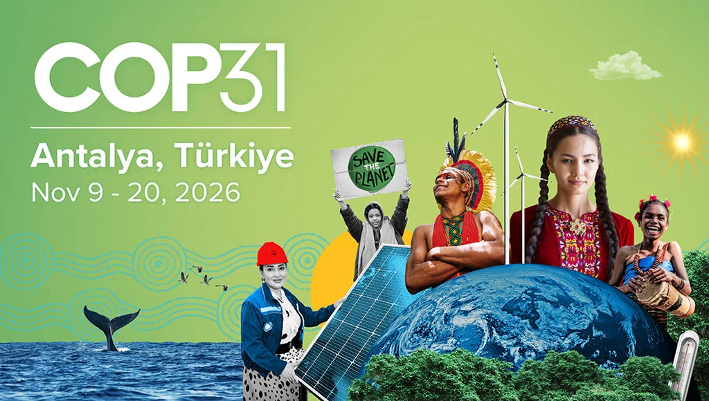
It is against this backdrop that the 31st UN Climate Change Conference opens in Antalya, Türkiye, on November 9. The environment ministry has already formed a technical committee to draft a position paper and explore joint positions with the Least Developed Countries Group, Nepal and Bhutan — a welcome step. But the real question is: what exactly should Bangladesh demand in Antalya?

This year’s conference comes at a turbulent time. After the US-Israel war on Iran broke out in early March, shipping through the Strait of Hormuz came to a near halt and Qatar suspended liquid natural gas deliveries. Around 72 per cent of our imported LNG comes from Qatar and the UAE. Within days, Bangladesh was buying spot LNG at nearly two and a half times the earlier price and the South Asian Network on Economic Modeling estimates that the shock could cut gross domestic product by up to 1.2 per cent.

The crisis is a reminder that dependence on imported fossil fuels is not just a climate risk, but an economic and national security risk too. Making rooftop solar easier for factories, government buildings and homes would advance energy security and emission cuts together.

The war is also taking a toll on climate finance. According to the Stockholm International Peace Research Institute, global military spending reached a record $2.89 trillion in 2025, rising 14 per cent in Europe alone. Meanwhile, developing countries received only $26 billion in international public adaptation finance in 2023 — less than one per cent of a single year’s military spending against needs estimated at $310–365 billion a year by 2035.

The UK has cut overseas aid to boost defence spending. At COP30, wealthy nations promised to triple adaptation finance; in June, at the UN climate talks in Bonn, several of them resisted committing to a plan to deliver it. There is never a shortage of money for weapons, yet the countries whose emissions created this crisis are dragging their feet when it comes to supporting those who suffer most.

According to the Global Climate Risk Index 2026, Bangladesh is the 13th most climate-vulnerable country in the world. But my bigger worry lies elsewhere. Our research, using multiple carbon neutrality scenarios, found that even after the world reaches carbon neutrality, the intensity of extreme rainfall in monsoon regions does not easily return to earlier levels. The risk of floods like Feni’s will stay high for a long time. The embankments, drainage systems and cities we plan today must therefore be designed for the rainfall of the future, not the past. And with high-resolution climate models and machine learning, such extreme rainfall can now be forecast much earlier than in 2024.

A key document for this preparation is the Nationally Determined Contribution 3.0, which sets an unconditional target of cutting emissions by 6.39 per cent by 2035, at an estimated cost of around $116 billion. Its costed chapter on ‘just transition’ is a strength, but the Centre for Policy Dialogue has shown that its power-sector target is weaker than in the previous NDC. Progress on the NDC and the National Adaptation Plan should also be made public every year; the moral weight of asking for money abroad depends on transparency at home.

Other gaps at home are just as clear. Ahmedabad in India reduced heat-related deaths through a heat action plan; why can’t Dhaka, Rajshahi or Chuadanga have one? The Sundarbans remain our strongest natural shield, as Cyclones Sidr and Aila proved, and deserve far more investment. And for people who lose their homes to river erosion and salinity and end up in urban slums, the 2021 national strategy on climate-induced displacement is barely visible on the ground.

At the UN General Assembly in September, prime minister Tarique Rahman spoke of climate justice, finance and adaptation support. In Antalya, these words must become concrete demands. First, a time-bound plan for tripling adaptation finance — as grants, not loans. Second, simpler access to the Fund for Responding to Loss and Damage. Third, international recognition for climate-displaced people. Fourth, support for a regional early warning system and real-time sharing of river and rainfall data with upstream countries; the 2024 floods showed how deadly the lack of such information can be. Bangladesh should also ask that the EU’s Carbon Border Adjustment Mechanism does not, as its scope expands, become a new burden on vulnerable countries’ exports. These demands will carry more weight if raised together with the LDC Group and other vulnerable nations.

For years, Bangladesh has been a familiar example of climate disaster on the global stage and we have received plenty of sympathy. But a wide gap remains between what is promised and what is delivered. To close it, we must put our own house in order and press firmly for what is rightfully ours — not as charity, but as a right.

What matters far more than who said what in Antalya is whether the next flood in Feni comes with a warning in time and whether a village in Satkhira finds drinking water a little easier to get. That is the yardstick by which COP31 should be judged.

Md Babul Miah is a PhD researcher in climate and ocean modelling at Jeonbuk National University, South Korea.​
 

Rising tourist numbers put Saint Martin’s Island at risk

Saint Martin’s was declared an Ecologically Critical Area in 1999. Lighting up the beach at night, making excessive noise and holding barbecues are prohibited. Various restrictions are also in place to protect the coastal vegetation and biodiversity.

Sujoy Chowdhury


1793319444396.webp

Under pressure from excessive tourist numbers, the country’s only coral island, St Martin’s, is facing a serious crisis. Sourav Das

To protect Saint Martin’s Island’s natural environment, the daily limit on visitors had been set at an average of 2,000. This year, the government has raised it to 3,500. The period during which tourists can stay overnight has also been extended from two months to four and a half months.

But questions have been raised over whether an updated scientific study has been conducted to determine how much additional pressure the island’s water resources, waste management systems and natural environment can withstand.

Saint Martin’s is an ecologically critical area. More tourists mean greater demand for drinking water, more sewage and rubbish, and heavier foot traffic on the beaches. Environmentalists have questioned whether these pressures were properly considered when the new limit was set.

They say the island still lacks adequate facilities to cope with the previous limit of 2,000 visitors a day. Allowing another 1,500 tourists could put its natural environment at further risk.

Under the government’s decision, tourists will be allowed to visit Saint Martin’s from 1 November to 15 March. Each visitor will have to pay an environmental conservation fee of Tk 100. Confusion over overnight stays prompted the Ministry of Environment, Forest and Climate Change to issue a new notification on Tuesday, clarifying the matter. It states that tourists can stay overnight from 1 November. Previously, overnight stays were allowed only in December and January.

Alongside restrictions on tourism, the interim government had also taken steps to create alternative livelihood opportunities for island residents. A project was launched to provide training for locals and financial assistance for two months to a selected number of families directly dependent on tourism.

Saint Martin’s was declared an Ecologically Critical Area in 1999. Lighting up the beach at night, making excessive noise and holding barbecues are prohibited. Various restrictions are also in place to protect the coastal vegetation and biodiversity. Questions have now arisen over whether enforcement of these restrictions will be strengthened alongside the increase in tourist numbers.


Photo shows the ‘UNO Resort’ being constructed in the southern part of Saint Martin’s Island in violation of the law on 9 August 2026. Prothom Alo

After 5 August 2024, the former interim government restricted tourist visits to Saint Martin’s. From November to January, a maximum of 2,000 tourists a day could visit the island through an online registration system.

For the rest of the year, the island remained almost free of tourists. Over the past two tourist seasons, 237,000 people visited the island—less than half the number recorded three years earlier. This also brought environmental benefits.

Alongside restrictions on tourism, the interim government had also taken steps to create alternative livelihood opportunities for island residents. A project was launched to provide training for locals and financial assistance for two months to a selected number of families directly dependent on tourism. A draft master plan for Saint Martin’s was also finalised, emphasising an approach to tourism that would be community-centred and environmentally friendly.

1793319615357.webp

A tourist ship on its way to Saint Martin's island. Prothom Alo

A senior source at the Ministry of Environment told Prothom Alo that shipowners and hotel and resort operators had sought permission for at least 6,000 tourists to visit the island each day. Following discussions, the proposed number was reduced to 3,500.

Attempts were made to contact Environment Minister Abdul Awal Mintoo for comment on the increase in tourist numbers, but he was unavailable due to a busy schedule.

Environmentalists say the island had begun to benefit from measures introduced by the interim government. With fewer tourists visiting, less rubbish was being dumped on the beaches.
Questions were also sent to Toffazzal Hossain, the ministry’s public relations officer, but no response was received. Ministry Secretary Fahmida Khanam is currently abroad. She was contacted via WhatsApp and sent written questions, but did not respond.

Concerns that the environmental gains could be lost

Decades of unplanned tourism and uncontrolled construction have damaged Saint Martin’s natural environment. During the Awami League government’s tenure in particular, hotels, resorts and cottages sprang up across the island. Many of these structures lacked environmental clearance and fire safety approval. There was also no limit on the number of tourists. As visitor numbers grew, so did plastic and other waste, polluting the beaches and surrounding sea.

Environmentalists say the island had begun to benefit from measures introduced by the interim government. With fewer tourists visiting, less rubbish was being dumped on the beaches.

Allowing 1,100 to 1,200 tourists a day would be reasonable, given the island’s environmental carrying capacity. Yet the daily limit has been raised to 3,500 without any significant improvement in drinking water supplies, waste management or essential infrastructure. Mohammad Kamal Hossain, Supernumerary Professor, Institute of Forestry and Environmental Sciences, Chittagong University.

Research also indicated that seawater quality had improved while tourism was suspended. The natural environment had begun to recover, at least to some extent, from years of pollution and unrestricted human activity.

Now, with the daily tourist limit increased by 75 per cent at a stroke, there are concerns about whether those gains can be sustained. More tourists will mean greater water consumption at hotels and resorts, along with more sewage, plastic bottles and food packaging.

Without adequate facilities to treat and dispose of waste, pollution could spread to the beaches and sea. Human activity will also increase around coral reefs and marine habitats.

Mohammad Kamal Hossain, supernumerary professor at the Institute of Forestry and Environmental Sciences at the University of Chittagong, told Prothom Alo that allowing 1,100 to 1,200 tourists a day would be reasonable, given the island’s environmental carrying capacity.

Yet the daily limit has been raised to 3,500 without any significant improvement in drinking water supplies, waste management or essential infrastructure. A scientific assessment of how much pressure the island could withstand should have been conducted before increasing visitor numbers, he said.

Highlighting the sensitivity of coral reefs and marine biodiversity, he said mass tourism might be suitable for Cox’s Bazar, but the same approach was in no way acceptable for Saint Martin’s. The island’s natural environment should not be put at risk for tourists’ entertainment. Increasing visitor numbers to satisfy people involved in the tourism business would only harm the environment, he added.

Less tourist pressure helps the environment recover

Saint Martin’s is Bangladesh’s only coral-rich island and an important habitat for the country’s marine biodiversity. According to the Department of Environment, the island was once home to around 1,076 species.

It provided a safe habitat for coral, sea turtles, algae, shells and various species of migratory birds. Over the past two decades, plastic pollution and unplanned construction have led to the loss of many species.

Recent research suggests that reducing tourist pressure can improve the island’s environment. A study published in the Journal of Environmental Management and Tourism in May 2026 found that dissolved oxygen levels in seawater increased significantly while tourism was suspended from February to October 2025. Researchers view this as a sign of improvement in the marine environment.

Syeda Rizwana Hasan, chief executive of the Bangladesh Environmental Lawyers Association (BELA), told Prothom Alo that the decision to increase tourist numbers had no scientific basis. In the past, relevant agencies, including the Department of Environment and the Bangladesh Oceanographic Research Institute, were involved in setting limits on visitor numbers and overnight stays.

This time, the number of tourists was increased at the request of resort owners and local political figures, she said.

In her view, environmental considerations could justify reducing tourist numbers, but not increasing them. She also said it was necessary to clarify how the Tk 100 collected from each tourist would be spent.

Syeda Rizwana Hasan, who served as environment adviser in the former interim government, said the administration had already struggled to enforce the previous limit of 2,000 tourists a day. Her question is: how will the authorities effectively monitor 3,500 visitors a day?​
 

Attachments

  • 1793319552613.webp
    1793319552613.webp
    89.5 KB · Views: 1

Threat to mangrove ecosystem

Gouranga Nandy


1793406397535.webp


THE government is moving forward with plans to construct a floating storage and re-gasification unit terminal at Akram Point in the Sunderbans. Located in the lower reaches of the Ganges delta, Akram Point lies on the south of the Sunderbans. The world’s largest contiguous mangrove forest is a UNESCO world heritage site and a designated Ramsar site. The coastal estuarine environment is highly complex. The ecosystem supports significant global biodiversity, fisheries and coastal livelihood and provides for natural protection against cyclones, tidal surges and coastal erosion.

This is the location being considered for a floating storage and re-gasification unit terminal, which could facilitate the import of liquefied natural gas to be fed into the national grid. However, its viability cannot be assessed solely in terms of gas import logistics. It must be evaluated by considering the site’s ecological sensitivity, navigational and geotechnical conditions, vulnerability to extreme weather, the risk of accidents and the cumulative impact of the associated infrastructure. The question is: can a liquefied natural gas terminal be established at Akram Point without creating unacceptable risks for the Sunderbans and the communities living in the surroundings? Furthermore, what are the potential environmental and engineering risks associated with the establishment of such a terminal?

A floating storage and re-gasification unit is a specialised vessel that receives liquefied natural gas from carriers, stores it at the required temperature, re-gasifies it into natural gas and delivers that gas to the shore or into the national transmission network. A typical terminal requires several interconnected components. They include a floating storage and re-gasification unit vessel and a gas transfer system, mooring facilities, offshore berths or buoy-based mooring systems; a designated navigation channel and an approach route for vessels, gas pipelines, subsea connections and onshore receiving facilities, gas metering, pressure control, emergency shutdown systems and control infrastructure as well as supporting activities such as dredging, anchoring, maintenance and marine services. There are requirements for access routes, power supply, communication systems, and other onshore infrastructure.

The environmental impact of a terminal is, therefore, not limited to the floating vessel alone. It also encompasses the navigation routes, shipping channels, pipeline construction zones and all supporting facilities. Another critical technical aspect involves the use of seawater or heat from other sources for the re-gasification process, which can trigger various environmental responses.


Akram Point is situated at the confluence of the Passur and Shibsa rivers, the main channel leading to Mongla port, which cuts through the Sunderbans, with wildlife sanctuaries on both sides. These rivers serve as habitats for the endangered Ganges river and Irrawaddy dolphins.

The construction of the proposed terminal must take into account four key characteristics of the site: the tidal river system, where water levels, currents, sediment transport and salinity fluctuate with the tides and the seasons; mangrove-dependent ecological processes, which rely on specific sediment conditions, tidal exchange and functional root systems; aquatic and terrestrial wildlife, including fish, dolphins, birds, reptiles and forest mammals, which depend on interconnected habitats; and coastal protection functions: mangrove vegetation and the associated intertidal landscape help reduce erosion and the impact of waves.

According to UNESCO, large-scale industrial development in the vicinity of the Sunderbans could threaten the region’s outstanding universal value and natural environment. A primary potential environmental risk is damage to the mangrove forest and its root systems. The forest is home to mangrove species adapted to tidal inundation, saline water and waterlogged, silty soil. Industrial pipelines, access infrastructure, dredging and other activities could damage this forest and its vegetation. Construction projects could harm these specialised habitats. During pipeline construction, mangrove roots may be severed or buried underground. Sediment deposition and erosion patterns along riverbanks could be altered. Tidal drainage and water flow dynamics may also be disrupted, while the growth of seedlings and natural regeneration could be hindered.

Climate change and reduced freshwater flow from upstream have already increased salinity levels. If the specialised aerial roots of the mangroves are repeatedly buried, whether by construction activities or sediment, the mortality rate of the trees is likely to rise. The proposal to lay pipelines by excavating the surface within the mangrove forest is concerning. It is suggested that the pipelines will be installed by excavating the riverbed, which would pose a significant challenge to the saline, muddy environment essential for the mangroves.

Furthermore, large LNG-carrying vessels require sufficient water depth, adequate space for navigation and suitable conditions for manoeuvring and berthing. There is considerable doubt as to whether such vessels could reach Akram Point without extensive dredging, given the high rate of sediment deposition in the Meghna estuary and the areas to its west. Despite extensive and costly dredging in the Ramnabad channel of Payra port, it has not been possible to maintain normal vessel movement. Near Akram Point, downstream, at Hiron Point, the confluence of the Passur and Kunga rivers, the rate of sediment deposition is exceptionally high. Regular dredging is essential to keep the navigation channel operational. However, the dredging process re-suspends fine sediments, increasing the turbidity of the river water. This reduces light penetration, which harms aquatic plants and microscopic algae. Bottom-dwelling life, molluscs and fish spawning habitats can get buried or suffocated. Furthermore, pollutants previously trapped in the riverbed sediments are released back into the water column. Dredging also alters the channel’s geometry, local current patterns, riverbank erosion rates, and sediment deposition dynamics. There is often no alternative to dispose of the dredged material either within the river itself or inside the Sunderbans. Consequently, continuous dredging can become a significant environmental burden.

The increased movement of carriers, the operation of tugboats, dredging activities and underwater noise will disrupt the natural rhythms of aquatic wildlife. Key risks include dolphins being injured or killed by vessel collisions or propeller strikes. Underwater noise interferes with the dolphins’ ability to communicate, navigate and locate prey. Shallow-water foraging habitats may be damaged or degraded. Additionally, fish, including their eggs and larvae, as well as benthic organisms, face an increased risk of injury or mortality. Both Ganges river dolphins and Irrawaddy dolphins rely heavily on acoustic information to navigate their turbid riverine environments; while underwater noise may go unnoticed by humans above the surface, it is profoundly significant for these aquatic animals.

While construction-related noise is typically temporary, the noise generated by operational vessels can persist for decades. The frequency of vessel traffic, along with the specific routes and speeds of these ships, poses a serious danger to the aquatic fauna inhabiting the area.

Re-gasification is another significant factor. Converting liquefied natural gas, stored at about -162°C, back into its gaseous state requires the application of heat. If seawater is used as a heat source, large volumes of chilled water would be discharged back into the sea, altering local temperatures. This would place stress on temperature-sensitive aquatic organisms, potentially harming fish eggs, larvae, and plankton.

The actual risks depend largely on the re-gasification technology employed. Carriers and support vessels carry fuels, lubricants, hydraulic fluids and other operational materials. Accidental spills, leaks during refuelling, or improper waste disposal could contaminate the estuary. This process would further exacerbate the pollution already caused by the routine waste discharge from vessels calling at Mongla port.

Floating oil can alter plant tissues and harm fish, crustaceans, molluscs, birds, and other wildlife. Some impacts may persist even after the visible oil has disappeared.

Other potential sources of pollution include bilge water and oily wastewater from vessels; cleaning agents and maintenance chemicals; antifouling substances and corrosion-control products; as well as sewage and solid waste discharged from ships. While liquefied natural gas is volatile, a leak could still pose a risk of severe fires or the formation of hazardous vapour clouds.

Furthermore, the presence of terminal lighting, machinery, watercraft, service vehicle traffic, and pipeline-related activities can disturb wildlife inhabiting riverbanks, forest edges and adjacent waterways. Potential impacts include the disruption of wildlife movement between feeding and resting areas. Noise and human activity may disturb the lives of tigers, deer, wild boars and other mammals. Artificial lighting could alter the behaviour of nocturnal species. Pipelines or access infrastructure may create barriers, leading to the fragmentation of habitats. Furthermore, as work sites draw people into forested areas, the frequency of human-wildlife encounters is likely to increase. Even without large-scale forest clearing, persistent disturbance can force animals to alter how they use their habitat.

Many coastal households, which rely, directly or indirectly, on fishing, crab harvesting, the collection of forest resources or river-based transport, will face significant losses. If the availability of aquatic resources declines due to dredging, vessel traffic, habitat degradation, or pollution, local communities, particularly fishers, will see a reduction in their catch and, consequently, a drop in their income. Small boats will be unable to access the terminal area and will be forced to take alternative routes, resulting in increased travel time and costs. Small-scale fishers, low-income households, and those with limited livelihood alternatives are the most vulnerable to such economic setbacks.

It goes without saying that environmental impacts and engineering risks are closely intertwined. The failure of anchoring equipment, a pipeline, or a ship-transfer system could trigger a pollution incident. Conversely, poor engineering decisions regarding dredging or coastal protection measures could cause long-term environmental damage.

A key engineering question is whether the site can safely accommodate a vessel under realistic tidal and weather conditions. This involves assessing factors such as the vessel’s draft, under-keel clearance, tidal windows, channel width, the geometry of the turning basin, and the availability of sufficient manoeuvring space for emergency situations. A mere nominal depth is insufficient for the construction of this type of terminal. Due to siltation, vessels may become stranded on shoals, come into contact with the seabed, or collide with navigational infrastructure.

Grounding may occur, and access could be restricted during adverse weather conditions; consequently, this may lead to disruptions in LNG supply.

Although a floating storage and re-gasification unit is a floating vessel, the associated infrastructure may require foundations, anchors, piles, pipelines, and onshore facilities. The deltaic sediment surrounding the Sunderbans varies significantly in terms of thickness, strength, and composition. It is also unclear whether the seabed and riverbanks can adequately support the proposed structures. Potential risks include low load-bearing capacity or uneven ground subsidence; instability or reduced holding capacity of anchors; and issues with pipelines, such as subsidence, unsupported spans, or excessive bending. Other risks include erosion around piles, anchors, or water intake and discharge structures; slope instability and bank erosion near pipelines; and damage to subsurface infrastructure caused by sediment migration.

The coastal region is prone to cyclones, storm surges, strong currents, and extreme weather conditions. A moored floating storage and re-gasification unit must remain stable under combined forces of wind, waves, currents, vessel motion, and the influence of passing ships. Mooring lines, chains, and anchors must be capable of withstanding extreme stress; otherwise, components of the mooring system could fail. In extreme weather, the vessel might shift from its position, potentially damaging gas transfer arms or flexible hoses. There is also a risk of collision between the unit and carriers or support vessels. Furthermore, adverse weather could hinder safe access for emergency responders. During the design phase, it is essential to ensure that the infrastructure can withstand not only normal operational conditions but also extreme environmental stresses. Furthermore, specific measures must be in place ahead of a cyclone, such as halting gas transfers, disconnecting transfer equipment, relocating personnel to safety, and securing the terminal. Gas is transferred from carriers to the unit using specialised equipment. The process could be disrupted, potentially causing accidents, due to equipment malfunction, improper connections, excessive vessel movement or human error. It is worth noting that a fire incident occurred at the Maheskhali terminal in July.

A leak can result in the release of an extremely cold liquid and the rapid formation of a vapour cloud. Depending on prevailing conditions, this cloud could disperse, accumulate in a specific area, or ignite upon contact with a source of fire.

The pipeline connecting Akram Point to Mongla, or any other receiving facility, introduces additional engineering and environmental risks. They include corrosion, material degradation, and defects in welds or joints. Other risks involve external damage caused by anchors, dredgers, or maritime activities; shifting or subsidence of the seabed or riverbed; excessive bending or stress on the pipeline while crossing channels; damage during the crossing of coastal areas or riverbanks; and leaks or breaches in valves, joints, or pressure-control installations. Furthermore, there is the risk of delays in detecting leaks in remote areas. The release of gas under high pressure could also lead to fires or explosions.

The establishment of a floating storage and re-gasification unit terminal will increase the movement of large vessels within a river system influenced by tides. Collisions or groundings could occur due to factors such as poor visibility, strong currents, equipment failure, human error, inadequate channel geometry, or unforeseen incidents involving other vessels. This will increase risks for fishing boats and other small vessels.

Above all, there is a significant legal issues surrounding the terminal proposed for Akram Point. There is no legal provision for authorising the construction of facilities or projects that could adversely affect the Sunderbans. Simply obtaining environmental clearance does not render the project legally valid. The government must establish the legal viability of this project. If UNESCO deems the project or facility unacceptable, the nation’s reputation will be at risk. Before finalising this proposal, which poses serious concerns for the mangrove ecosystem, the environmental and engineering risks must be carefully considered. Should we implement such a project in such a sensitive area?

Gouranga Nandy is an independent journalist and writer on environmental issues.​
 
Back
Top