Bangladesh Defense
Saif
Senior Member
- Messages
- 14,314
- Reaction score
- 7,554
- Origin

- Residence
- Axis Group

Source
:
https://www.PKDefense.com
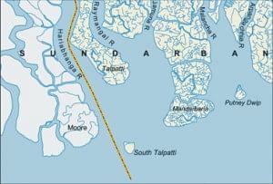
The following video elaborates how India deprived Bangladesh of its legitimate ownership over South Talpatti.