[🇧🇩] Space Program in Bangladesh

  • Thread starter Thread starter Saif
  • Start date Start date
  • Replies Replies 36
  • Views Views 2K
G Bangladesh Defense Forum
[🇧🇩] Space Program in Bangladesh
36
2K
More threads by Saif

Saif

Senior Member
Jan 24, 2024
10,603
5,875
Origin

Residence

Axis Group

What does Bangladesh’s space research organisation really do?​


1710199527232.png

What does Bangladesh’s space research organisation really do? Visual: Teeni and Tuni

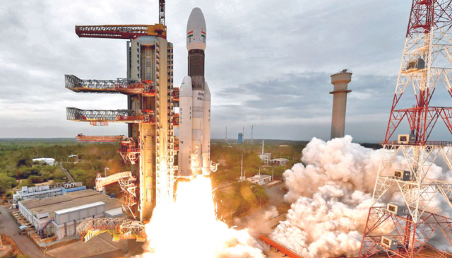
India's recent moon landing success raised a lot of curiosity and interest in Bangladesh and Pakistan. The question many people raised was: "Why couldn't we achieve something like this?" Bangladesh's Space Research and Remote Sensing Organisation (SPARRSO) came under scathing criticism from netizens.

Intrigued, I decided to find out more about SPARRSO from its website.

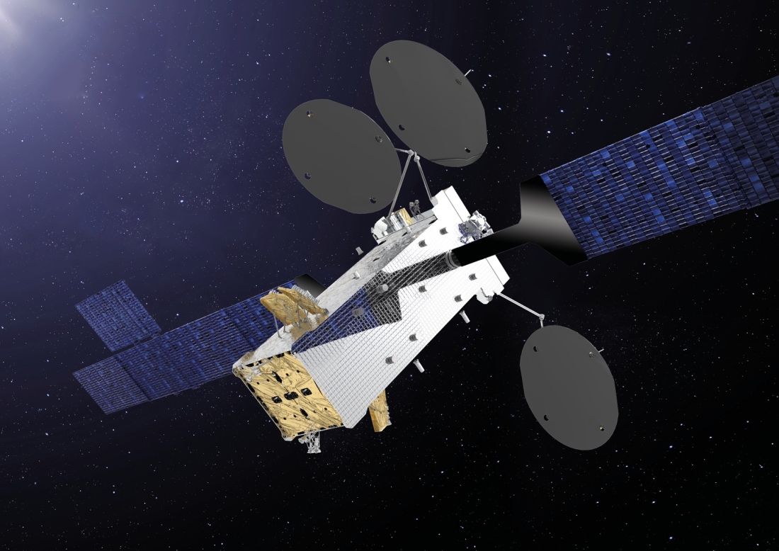
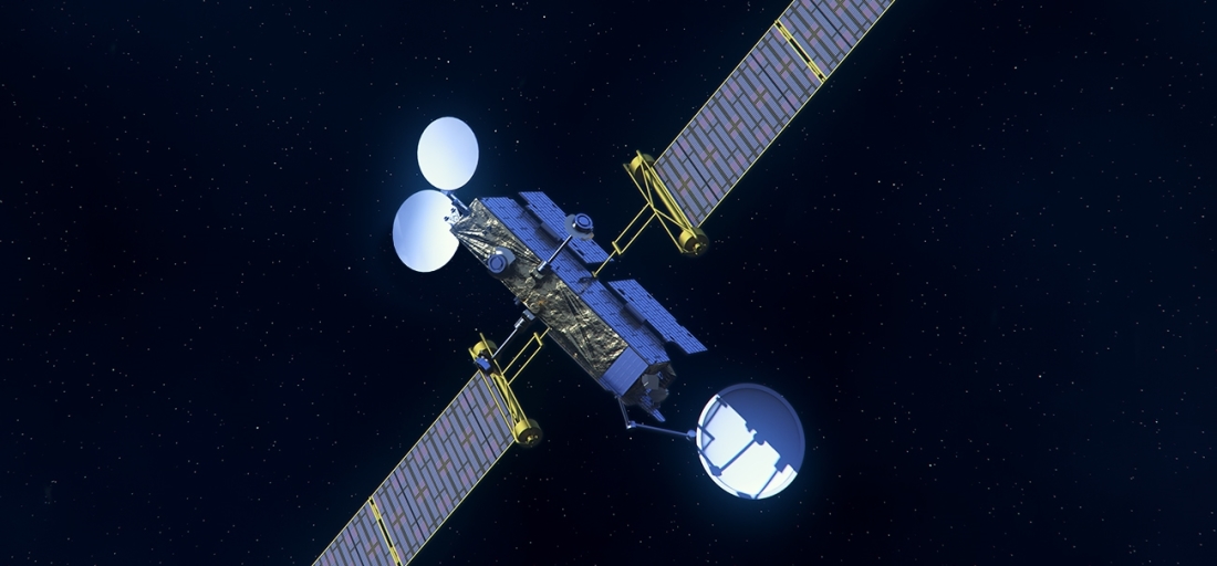
Founded in 1968 as the American space programme's Automatic Picture Transmission (APT) ground station, it is supposed to contribute to national development by peacefully applying space science and technology (vision statement). In 1972, when NASA launched its Earth Resources Technology Satellite (ERTS) – later renamed Landsat – SPARRSO continued active collaboration with it and later with Japanese and European space programmes.

That partnership has continued since. In May last year, NASA integrated its satellite data with observations from Bangladesh Meteorological Department (BMD) to enhance the country's ability to forecast extreme weather events. That means SPARRSO is active, but either it is not informing the public of its work or not meeting expectations. According to its website, SPARRSO had only two achievements in over 50 years: 1) NASA Group Achievement Award in 1986 and 2) Bangladesh Independence Award by its chairman in 1998. It offers only five data sets to the citizens, which are 33 years out-of-date (maps and images covering Dhaka, Chattogram, and Bangladesh, published between 1985 and 1990). There are only eight ongoing research programmes with a combined budget of just under Tk 88 lakh ($80,000 at the current exchange rate). With such a paltry allocation, we cannot expect any earth-shattering (or moon-shattering?) performance.

We, however, must be realistic. SPARRSO's mission is not necessarily sending lunar missions but using space technology for peaceful purposes. As such, it can focus on leveraging this technology and supporting Bangladesh's development journey. A few cases in other countries might clarify this point.

In 2012, India launched a programme called KisaanMitr (Farmers' Friend) to give farmers free personalised weather forecasts (from satellite data) and agricultural advice via SMS three times a day. Research showed that it led to greater compliance with agro-meteorological advisories in scheduling operations based on crop growth cycle. It also increased the use of rainwater as a groundwater or surface irrigation substitute.

In Brazil, the police hardly ever investigated environmental crimes because locating isolated illegal deforestation was difficult. In 2018, it adopted the online forest monitoring platform Global Forest Watch, which detects areas of tree cover loss using satellite imagery. With this, the police can quickly identify areas of illegal deforestation and combat them more effectively.

Senegalese farmers have improved their yields and reduced losses due to disease by monitoring crop health and identifying areas of crop stress with satellite imagery. The programme, in collaboration with the Global Partnership for Sustainable Development Data, uses Artificial Intelligence (AI) to predict crop yields and enhance food security by guiding the farmers, planning food storage and transport, and helping policymakers focus on the most vulnerable communities.

In Kenya, satellites map soil moisture levels with which farmers optimise their irrigation schedules. It improves crop yields and saves water, reducing the risk of crop failure due to drought. The Directorate of Resource Surveys and Remote Sensing (DRSRS) is working on a national digital programme for a satellite-based AI-powered crop monitoring and yield forecasting system. With it, the farmers will make smart and data-driven farming decisions, and monitor crops. Last year, Kenya joined UNCTAD's CropWatch programme to monitor its crops better and protect them from floods and other hazards. CropWatch uses satellite data to monitor crop conditions and integrates this with other climate-related data on drought, pests, and disease for better farm management.

None of these countries, save India, sent satellites into space but effectively uses data from others' satellites. Essentially, they collect relevant data from various sources, process them to produce useful information, and deliver the products effectively to the end users (e.g., farmers).
Aside from agriculture, there are many other fields where satellite imagery and advanced data processing can offer valuable insights. These include environmental conservation, disaster management, urban planning, infrastructure development, water resources management, public health management, and disease control. Each area can immensely benefit from satellite data but discussing them in a short article is impossible. Using satellite data effectively, Bangladesh can unlock space programmes' transformative potential for a more prosperous and sustainable future.

Here is a case. Landsat satellites cover the earth every 16 days and provide data for free downloading within a few minutes. However, such data are not precise as their pixel size is 30m (i.e., a 30x30m block on the ground becomes one number in the satellite data). These data cannot help in detailed studies that require higher precision. However, commercially available satellites offer accuracy in centimetres, even millimetres. These are expensive and not easily available. SPARRSO can act as a medium to procure such data and disseminate it to government and private users, charging a fee to recover the cost (making it commercially viable).

Bangladesh's space programme can indeed do a lot on the ground. But that needs sustained investment in education, research, joint programmes with universities and research organisations, technology transfer from advanced countries, and a long-term vision. Launching satellites is only one part of a space programme; the more significant part remains how the data is processed to glean valuable insights.​

Dr Sayeed Ahmed is a consulting engineer and the CEO of Bayside Analytix, a technology-focused strategy and management consulting organisation.
 

Space Research and Remote Sensing Organization

The Bangladesh Space Research and Remote Sensing Organization (Bengali: বাংলাদেশ মহাকাশ গবেষণা ও দূর অনুধাবন প্রতিষ্ঠান ,, romanized: Bangladesh mohakash gobeshona o door onudhabon protishthan), or SPARRSO (Bengali: স্পারসো), is a state agency concerned with astronomical research and the application of space technology in Bangladesh. SPARRSO works closely with JAXA, NASA and the ESA in environmental and meteorological research. Using Japanese and American satellites, SPARRSO monitors agro-climatic conditions and water resources in Bangladesh.[1]

Activities

Broad Category of SPARRSO Activities

Category 1: Operational Activities towards National Interest

Category 2: Research & Technological Development Activities

Category 3: Activities to Support National Development

Category 4: Nation Building Mile Stone Activities of SPARRSO

Category 5: Human Resource Development on RS & GIS Technology

Commandment

SPARRSO has been applying space and remote sensing technology, in the field of Agriculture, Forestry, Fisheries, Geology, Cartography, Water Resources, Land use, Weather, Environment, Geography, Oceanography, Science, Education, science-based Knowledge and other related space research areas. It also performs research on these activities for developing this technology and its practical application.

Provides necessary information and disseminates research results to the Government and different relevant user agencies.

It provides the Government information about the development of space and remote sensing technology in other countries and gives advice for the formulation of national policy to the Government.

Conducts training, technical research, and surveys, and cooperates with national or international organizations or institutes in the relevant matter.

SPARRSO creates development projects to perform research activities on space and remote sensing technology and implements them with approval from the Government.

SPARRSO takes measures regarding the above-mentioned work as it feels necessary.

Divisions

At present, there are total 17 working divisions in SPARRSO(স্পারসো). They are:

Atmospheric Division
Agriculture Division
Agro-hydrometeorology Division
Forestry Division
Water Resources Division
Oceanography Division
Fisheries Division
Cartography Division
Ground Station Division
Photographic Division
Ocean Physics Division
Instrumentation and Data Processing Division
Ground Truth Division
Geology Division
Rocket Technology Development Division
Space Physics & Rocket Dynamics Division
Regional Remote Sensing Center (RRSC)

Ground stations

Here is the list of total ground stations at SPARRSO:

Geostationary Satellite
MTSAT-2 of Japan
FY-2D & FY-2E of China
WINDS of Japan.
Polar Orbiting Satellite.
NOAA Series of USA
Terra & Aqua of USA.
MetOp of Europe

Research

SPARRSO conducts research works on various aspects of geo-disciplinary subject areas of RS-GIS technologies.

The research items includes technological development on RS-GIS algorithms, with the aim to develop better techniques for geoinformation retrieval along with effective approaches towards fruitful application of such technology.
 

Bangladesh's ascent to galaxy: Should we emphasise space research?
Md Shiyan Sadik
03 Oct 2023 14:47:27 | Update: 03 Oct 2023 14:48:16


1710200506632.jpg

— Representational Photo

In spite of having a great number of graduates from physics, maths, or engineering departments of several public and private universities, Bangladesh is way behind other countries in terms of space research. The geopolitical narrative of space being controlled only by developed nations somehow created a borderline for our students to set their limit for the sky. However, the recent success of India has ignited the question of whether Bangladesh should aggressively emphasise space-related projects or not.

India has won praise from people all around the world for its successful Mars Orbiter Mission (Mangalyaan) in 2013, Chandrayaan-2 moon mission in 2019, and its ongoing dedication to space exploration. Geopolitical experts argue that this is one of the biggest stepping stones to be acknowledged as a superpower like the US, Russia, or China in the near future for India.

Being rational and realistic, the ambition of becoming a superpower does not resemble the case of Bangladesh. But to begin with, it may be time for Bangladesh to set aside some funding for the deployment of a new technical sector and for the improvement of the abilities of the ambitious.


Bangladesh has Space Research and Remote Sensing Organisation (SPARRSO), which works with the European Space Agency (ESA), NASA, and the Japan Aerospace Exploration Agency (Jaxa) to conduct environmental and meteorological research. If Bangladesh decides to actively engage SPARRSO with a much more utilitarian approach, the reasonableness of advancement of knowledge sharing and technological transfer can be facilitated through partnerships with India as they have already progressed in the loop.

This initiates the capacity development of future researchers and scientists interested in this field. Various sectors such as agroforestry, climate, and disaster management can be enriched with a new set of potential resource persons in the future.

Nevertheless, the most debatable discourse is whether the cost-benefit analysis in terms of economic gain supports this notion of space research or not. But to keep things in perspective, there is an underlying disguised economic benefit for launching space research on a macro scale.

On May 12, 2018, Bangladesh launched Bangabandhu-1 into Earth's orbit, and in May 2019, it started conducting commercial operations. In a 2012 feasibility study, the government stated that it hoped to break even on the satellite project, which was anticipated to cost Tk 3,000 crore, in seven years. This particular cost can be minimised to a greater extent if the model of India can be replicated here.

The cost of the Mars Orbitary Mission which is unofficially recognized as Mangalyaan was completed in a budget of only 453 crore rupees. The advancement in space research can significantly impact the budget of satellite launching which can be further propelled as a commercial satellite to generate a new revenue stream for Bangladesh.

Furthermore, space technology has the potential to improve our capacities in remote sensing, weather forecasting, and disaster management, resulting in improved agriculture, fisheries, and infrastructure development, and, eventually, economic growth.

The next narrative might be a bit more abstract compared to the quantitative positives of space research. From the historical evidence, space has been a bone of contention in amplifying the global polarisation paradigm. It can assist Bangladesh in becoming more involved in geopolitical decision-making. Bangladesh can obtain power dynamics at the table of global polarisation by participating in space exploration. This can assist Bangladesh in promoting its interests and increasing its worldwide prominence as a rising developed nation in the future.

Funding opportunities are there but it needs to be explored rigorously. SPARRSO can be the trump card to avail such opportunities. Compared to the Indian Space Research Organisation (ISRO), SPARRSO is less equipped in terms of technological factors and expert human capital. The experience bracket tilts around 1 year for most of the employees where ISRO has been armed with potential young scientists and experienced researchers.

The masses always had a negative impression in terms of space research provided the economic conditions of Bangladesh. But, not always democracy can be considered the right mechanism for making a decision. And the narrative of space being dominated by developed nations needs to be challenged as research should never be limited to geographical boundaries.

Bangladesh has mass potential in terms of creating new employment opportunities through space science which would not only include technological aspects but also administrative positions. It is crucial to provide a legal framework for space activities, such as satellite launches and space research. It might be difficult to ensure adherence to national regulatory standards and international space treaties and accords at the same time.

Space research is fresh. So is the new generation. A new opening and facilitation from the government is all they need to explore the world of stars.

The writer is a Lecturer at the Department of Environmental Science and Management at North South University.​
 

BANGABANDHU SATELLITE-1, THE PRIDE OF BANGLADESH!​

11 MAY 2020

Two years ago to the day, Bangladesh’s first satellite, Bangabandhu Satellite-1, was launched from Cape Canaveral in Florida on a Falcon 9.

The successful launch was celebrated across the country, with extensive media coverage.

Bangabandhu Satellite-1 contributes to boosting the country’s economy by providing all citizens with a wide range of telecommunications services (direct-to-home TV, radio, telemedicine, education and internet access). Hardly surprising that it was named in honor of Bangabandhu Sheikh Mujibur Rahman, the “father of the country”. Bangladesh was eagerly awaiting its first telecom satellite, since it helps the country affirm its independence in this area, and allow it to offer communications and broadcasting services to a number of neighboring countries, including Nepal, Myanmar and Bhutan.

Thales Alenia Space’s contribution​


bangabandhusatellite-1-reflectorsdeployment_1100_1_0.jpg


Built on Thales Alenia Space’s Spacebus 4000B2 platform, the satellite is fitted with both Ku and C-band transponders. Its coverage zone spans Bangladesh and neighboring regions. Positioned at 119.1° East, it will provide Ku-band services for Bangladesh and its territorial waters in the Gulf of Bengal, India, Nepal, Bhutan, Sri Lanka, the Philippines and Indonesia, while also offering C-band capacity over the entire region.

Thales Alenia Space was prime contractor for this turnkey system, working for the Bangladesh Telecommunication Regulatory Commission (BTRC). We were responsible for the design, construction, testing and in-orbit delivery of the satellite.


Bangabandhu%20Satellite%201%20-%20CATR_1100.jpg


Thales Alenia Space was also in charge of the ground segment, based on the dedicated SpaceOps solution for mission configuration and monitoring. This work package includes two buildings, for the satellite control center and operational network center, which is based on Thales Alenia Space’s comprehensive SpaceGate solution. Our partner in Bangladesh, Spectra Engineers Ltd., handled civil engineering for the ground infrastructure.

Like Brazil, Turkey and Argentine, exemplary cases of successful partnerships between Thales Alenia Space and countries wanting to join the space club and enhance their autonomy in space technology, the partnership set up for Bangabandhu Satellite-1 allowed Bangladesh to become a full-fledged member of the space community.

Driving economic growth and recognition in Asia​


Bangaladesh_School_Girl_1100.jpg


Bangladesh’s satellite contributes to bridging the digital divide in both large cities and rural areas. These isolated villages will gradually benefit from all the advantages of digital connectivity.

Bangabandhu Satellite-1 is a strong symbol, conveying the nation’s ambitious hopes and spurring the country’s economy, while also generating jobs. Even the slightest facts and figures posted on social media have stimulated unprecedented enthusiasm. The satellite is a fantastic driver of economic growth and recognition in Asia, supporting improvements in a number of different sectors across the region, including defense, telemedicine, training, online searches and videoconference services.

Bridging the digital divide worldwide​


Konnect_VHTS_1100_New.jpg


As reflected in Bangabandhu Satellite-1, Thales Alenia Space has always been a key industry partner in efforts to bridge the digital divide around the world. For example, we are now building EUTELSAT KONNECT VHTS, an advanced very high throughput satellite. This extremely powerful spacecraft (in the 500 Gbps class) will be able to bring high-speed internet connectivity even to the most isolated areas in Europe, zones where it’s difficult or impossible to set up terrestrial infrastructures.


SATRIA%20Artist%20View%20_1100.jpg

© Thales Alenia Space

Thales Alenia Space is also prime contractor for Indonesia’s SATRIA satellite. Also working to reduce the digital divide, like Bangabandhu Satellite-1, SATRIA is designed to connect some 145,000 different zones not currently linked via satellite or terrestrial networks, including 90,000 schools, 40,000 hospitals and public buildings, along with government facilities. Also a very high throughput satellite, SATRIA will help Indonesia develop its digital capabilities.

Space%20Inspire_1100.jpg


Through its different product lines, including proven expertise in constellations, Thales Alenia Space offers custom-tailored solutions that meet the emerging expectations of the telecommunications market. From satellites based on the Spacebus 4000 B2 platform, well suited to regional operators, to the Spacebus NEO family, the foundation of very high throughput satellites (VHTS) that enhance connectivity around the world, and Space Inspire, the latest all-digital and reconfigurable in-orbit product line, Thales Alenia Space delivers tailored connectivity and mobility solutions to operators from around the world to help bridge the digital divide.


Bangladeh_Delegation_1100.jpg


Today, celebrations are in order! Long live Bangabandhu Satellite-1, a very special satellite that we are very proud of having made, and one that all Bangladeshis are proud of, since it has become a priceless new part of their culture.

Copyrights: © Thales Alenia Space/Briot - © Thales Alenia Space/Imag[IN] - © Thales Alenia Space/Master Image Programmes
 
Why do people from such poor countries want a space program? Obviously do deflect the sad state of their situation. No intelligent person from Pakistan wants a space program at this point.

Only delusional Pakistanis and Muhajir neo-liberals crave for one. I had been against one and advocated the money being spent on population reduction.
Ancient Roman satirist Juvelan said, " Give them bread and circuses, and they will never revolt!" Occupy your brain with nonsense - this loves politicians!
"Bread and Circuses" is a metaphor that refers to a simplistic way of pacifying people. In the context of politics, the phrase describes the act of gaining public support not through exceptional public service or policy-making but by merely satisfying the fleeting and superficial needs of the people. Additionally, the phrase suggests that the sense of duty towards the community among the general population is being eroded or overlooked.
I explained this mass psychology here 🇵🇰 - Bread & Circuses (Panem et Circenses) : They Will Never Revolt
 
All in good time bhai. Time will arrive soon.
You guys were hoping that America would impose sanction on Awami League if they fail to give a free and fair election. But look how America betrayed us. Instead of imposing sanction, they are deepening ties with Awami league because that's what India wants. Our time will arrive soon only if the army ousts Awami league and declares martial law.
 
You guys were hoping that America would impose sanction on Awami League if they fail to give a free and fair election. But look how America betrayed us. Instead of imposing sanction, they are deepening ties with Awami league because that's what India wants. Our time will arrive soon only if the army ousts Awami league and declares martial law.

You know - Allah's justice works in myriad ways. Look at how Netanyahu is cornered, worldwide public opinion is against him now and will get ousted soon.

I never lose hope. In my life - I have seen this so many times. Injustice does not last long.
 
Ancient Roman satirist Juvelan said, " Give them bread and circuses, and they will never revolt!" Occupy your brain with nonsense - this loves politicians!
"Bread and Circuses" is a metaphor that refers to a simplistic way of pacifying people. In the context of politics, the phrase describes the act of gaining public support not through exceptional public service or policy-making but by merely satisfying the fleeting and superficial needs of the people. Additionally, the phrase suggests that the sense of duty towards the community among the general population is being eroded or overlooked.
I explained this mass psychology here 🇵🇰 - Bread & Circuses (Panem et Circenses) : They Will Never Revolt

Bookmarked this incredible post
 

Mongol-Tori Phoenix: BRAC University's next-generation Mars rover

1715039118882.png

Photos: Courtesy

Mongol-Tori's Phoenix, a next-generation Mars rover from BRAC University (BRACU), has secured a spot in the finals of the University Rover Challenge (URC) 2024, which will take place at the Mars Desert Research Station in Utah. The rover, which might alongside human explorers on the red planet someday, can retrieve objects, complete autonomous traversal missions, collect visual data, perform planetary analysis, detect the presence of life by conducting biosignature tests, and help astronauts with equipment servicing.

The Mongol-Tori team is supervised by their advisor, Dr Md Khalilur Rahman, an associate professor at the Department of Computer Science and Engineering Department of BRACU.

"We can't forget our constant source of support, Dr Khalilur sir, our team advisor, for always being there for us and helping us whenever we need it," said Mongol-Tori's team lead Al Mahir Ahmed. Apart from the supervisor and team lead, the innovative minds directly associated with Mongol-Tori include co-team lead Sanzim Khan, and sub-team leaders Zaiyan Azad Moslem (electronics), Rafid Khan (network and vision), Sheikh Ayatur Rahman (AI and autonomous systems), and Samiha Tashin (science mission).

Al Mahir is responsible for all technical aspects of the rover, focusing on control and autonomous systems. His role involves developing and implementing algorithms and software architectures crucial for the rover's navigation, manipulation, and decision-making processes.

Sanzim Khan oversees the mechanical aspects and team operations. He is essential to the overall development and operational preparedness of the rover, from engineering sturdy chassis and suspension systems to managing team-wide administrative and logistical responsibilities.

Zaiyan Azad Moslem oversees electricity distribution, circuit design, and protective systems. Using his knowledge of electrical engineering, he creates innovative methods to secure delicate electronics from environmental threats, maximise power efficiency, and guarantee dependable communication.

Sheikh Ayatur manages AI and autonomous systems development. Using cutting-edge machine learning algorithms and artificial intelligence approaches, he gives the rover the ability to sense its environment, process information, and come to wise conclusions on its own.

Rafid Khan takes charge of network and vision systems, ensuring rover communication and visual processing. To provide smooth communication between the rover and mission control and to enable real-time analysis of visual data, he develops and sets up monitoring systems, image processing algorithms, and network protocols.

Samiha Tashin leads scientific missions, including data analysis and sample collection. She designs and executes scientific experiments, interprets data collected by onboard instruments, and coordinates sample collection efforts to gather valuable insights into Mars' geological and environmental characteristics.

This year, the newer Phoenix rover comes with several changes and features that make it stand out and is engineered in a way to excel in extreme missions in Mar's terrain. The team's commitment to expanding the possibilities for robotic exploration is demonstrated by this new rover.

"The fresh new design takes inspiration from the phoenix bird itself and the red planet Mars, and most of the credit for the design goes to my co-team lead, Sanzim Khan, and his design team," said Al Mahir.

With omnidirectional wheels and a strong rocker-bogie suspension system, Phoenix offers unmatched performance on a variety of surfaces, coupled with a user-friendly graphical user interface (GUI). Even in the most hostile Martian conditions, its dual-band communication systems, which are precisely built for stability and increased range, ensure uninterrupted connectivity. This crucial component not only ensures reliable communication with mission control but also makes data transmission easier, which is necessary for successful mission completion and scientific analysis.

1715039176259.png


Phoenix's five-degree manipulator, an engineering marvel that enables unmatched precision in tackling complex jobs, is one of its most noteworthy enhancements. Its adaptability is further increased with the inclusion of omni-wheel steering, which allows it to navigate difficult terrain with unmatched agility and efficiency. The rover's sophisticated steering system makes it easy to manoeuvre in any direction, which makes it skilled at navigating difficult terrain. With the help of the Global Navigation Satellite System (GNSS) and the well-known Robot Operating System (ROS), Phoenix can perform autonomous navigation that raises the bar for robotic exploration. Phoenix's fundamental ROS allows it to adjust to changing conditions.

This year, at the URC, Phoenix achieved an outstanding System Acceptance Review (SAR) score of 87.38 out of 100, demonstrating its abilities in geological exploration and remote sensing. Phoenix showed an amazing ability to get into Martian surface materials with its Synthetic Aperture Radar (SAR) equipment and provide high-resolution, detailed photos of subsurface formations.

"We've faced all kinds of hurdles along the way, be it circuits burning, parts breaking down, and, every engineer's worst nightmare, a system that worked yesterday but stopped working today. We got through it all with a lot of determination, hope, and sticking together, I really can't be grateful enough for my team, they're a beautiful bunch," said Al Mahir Ahmed.

Mongol-Tori's team members are confident and looking forward to emerging victorious at the upcoming URC 2024.

Rittique Basak is a Campus Ambassador of The Daily Star from BRAC University.​
 

Deal for country's second satellite in three months
The satellite, Bangabandhu-2, will be launched in 3 years

1715554625824.png


The government will finalise a deal for the country's second satellite in three months and it will be launched in the next 2-3 years, said Shahjahan Mahmood, chairman of Bangladesh Satellite Company Limited.

The second satellite, Bangabandhu-2, will be an earth observatory satellite, he said.

It will be used for various purposes, including monitoring of natural disasters, managing agricultural resources, assessing environmental changes, Mahmood said.

He made the comments at the sixth anniversary of the launch of Bangabandhu-1, the country's first communication satellite, at a programme at the Dhaka Club today.

The Bangabandhu-1 satellite was launched in May of 2018 under a Tk 2,765.66 crore project.

Mahmood said the lifetime of Bangabandhu-1 could be increased by three years to 18 years, as it was efficiently launched six years back.

Some 40 Bangladeshi and 26 foreign television stations now air programmes using Bangabandhu-1 and the satellite has also started providing television rating point services recently.

In September last year, a letter of intent on cooperation was signed related to Bangabandhu-2 Earth Observation Satellite System between Bangladesh Satellite Company Limited and Airbus Defence and Space SAS of France.

The documents were inked in the presence of Prime Minister Sheikh Hasina and France President Emmanuel Macron at the Prime Minister's Office in Dhaka.

This time, Bangladesh has already signed a memorandum of understanding with France for the second satellite and its launch will help the south Asian country to face the challenges of the fourth industrial revelation, Foreign Minister Hasan Mahmud said in today's event.

State Minister for Telecom and ICT Zunaid Ahmed Palak and Post and Telecom Secretary Abu Hena Morshed Zaman also spoke.​
 
BRAC Onnesha was the first Cubesat Nano Satellite made by Bangladeshi students and researchers and launched as a multinational endeavor headed by Kyushu University in Japan (funding outlay borne was $500000 for Bangladesh side). More are planned in the future.

en.wikipedia.org
[H3]BRAC Onnesha - Wikipedia[/H3]

en.wikipedia.org
en.wikipedia.org
 

Latest Posts

Back