Donate ☕
[🇧🇩] - Earthquake in Myanmar----Lessons for Bangladesh | Page 5 | PKDefense

[🇧🇩] Earthquake in Myanmar----Lessons for Bangladesh

Reply (Scroll)
Press space to scroll through posts
G Bangladesh Defense
[🇧🇩] Earthquake in Myanmar----Lessons for Bangladesh
32
694
More threads by Saif


Frequent Earthquakes: Can Dhaka prepare itself for the big one?
UNB Dhaka
Published: 23 Nov 2025, 22: 55

1763948745229.webp

Dhaka City File Photo

Central Bangladesh, including capital Dhaka, the most densely populated megacity (population above 10 million) in the world has been shaken by a series of earthquakes over just two days, raising serious concerns about the city’s preparedness for a major tremor.

Experts have warned that the overpopulated capital of Bangladesh could become a hotspot for earthquake vulnerability, as nearly 90 per cent of its older buildings were constructed without adhering to proper building codes.

Concerns intensified following the powerful, 5.7-magnitude earthquake that struck at 10:38am on Friday, shattering the usual weekend calm and turning the holiday into a frightening experience for residents of the capital.

According to the Bangladesh Meteorological Department (BMD), the epicenter of the 26-second quake was in Madhabdi, Narsingdi, and its depth was recorded at just 10 kilometres below the surface.

The tremor, felt across several parts of Bangladesh, left at least 10 people dead - four in Dhaka, five in Narsingdi and one in Narayanganj. Over 600 people were also injured.

It is rare for earthquakes in Bangladesh to result in multiple fatalities. The last time it happened was in 1999, when an intense earthquake shook the island of Moheskhali, killing 6 people. Hundreds were also injured on the island off the coast of Chattogram in the country’s south-east.

But Friday’s quake was instantly recognisable as something different, with deeper repercussions. Besides the casualties being spread across three districts, the epicentre being so close to Dhaka caused a projected 10 million people in Dhaka to feel ‘strong shaking’, according to the United States Geological Survey, which is the leading authority on earthquake data worldwide.

Closer to the epicentre in Narsingdi, about 300,000 people were projected to have felt ‘high-intensity’ shaking. Literally everyone we spoke to in the capital confirmed they had never felt the ground shaking like it did during Friday’s quake.

It was followed almost exactly 24 hours later by a much smaller aftershock, again with its epicentre in Narsingdi’s Palash upazila. The BMD reported that this quake, measuring 3.3 on the Richter scale, occurred at 10:36am on Saturday, about 29 km west of the BMD Seismic Centre in Agargaon.

And then on Saturday evening, a third tremor in the space of 32 hours, considered a second aftershock of Friday’s quake, was felt in parts of Narsingdi and nearby districts including Dhaka. According to USGS, this latest quake measured 4.3 on the Richter scale and struck at 6:06pm local time, with its epicentre located 11 kilometres west of Narsingdi at a depth of 10 kilometres.

Even though no casualties were reported from either of the two aftershocks, they served to heighten anxiety, confirming that the fault lines lying deep beneath them in the earth’s crust had become seismologically active.

Several buildings across various areas of Dhaka were damaged after Friday’s earthquake. According to the Dhaka district administration, at least 14 buildings in the capital sustained damage from the quake, while the Rajdhani Unnayan Kartripakkha (Rajuk) put the number at over 50, including many that had tilted.

For survivors, the psychological impact lingers. For many, the ground no longer feels stable, and the fear of a stronger quake currently haunts millions across Dhaka.

“I am a student of Mujib Hall (2024–2025 session). I became traumatised because of the earthquake. I live in the July Smriti Bhaban of Mujib Hall. Now, whenever a vehicle passes by my building or I hear even the slightest sound, I panic,” a Dhaka University student shared.

“It feels as if another earthquake is happening. I repeatedly check my room and surroundings to see if there is a tremor,” he added.

At least four students were seriously injured after jumping from the residential hall buildings of Dhaka University in panic during Friday’s quake. The university ended up first cancelling all classes scheduled for Sunday, before a syndicate meeting on Saturday suspended all academic activities till December 6, citing the physical and mental stress caused by the earthquake and its aftershocks, as well as the need to renovate the residential halls.

Risky Buildings in Dhaka

According to RAJUK, the first list of risky buildings was prepared in 2010 and updated in 2016. Currently, Dhaka has 321 extremely risky buildings, mostly in Old Dhaka. In 2024, RAJUK also identified 30 risky buildings across 21 educational institutions.

A RAJUK survey conducted under the Urban Resilience Project between 2018 and 2022 found that approximately 865,000 buildings in Dhaka could collapse if a 6.9-magnitude earthquake struck the Madhupur Fault near Tangail. Such a scenario could result in 210,000 deaths and 229,000 injuries if it occurred during daytime hours.

Bangladesh’s cities, including Dhaka and Chattogram, remain highly vulnerable to earthquakes due to widespread disregard for building codes, master plans, and land-use zoning, according to the Institute for Planning and Development (IPD).

Adil Muhammad Khan, Professor at the Department of Urban and Regional Planning at Jahangirnagar University, emphasised the urgent need for preparedness, citing the recent 7.7-magnitude earthquake in Myanmar as a stark reminder of the risks.

Experts have also expressed concern that, despite the formation of multiple reform commissions, the interim government has yet to establish a dedicated authority for planned urbanisation, sustainable housing, and building safety.

The Bangladesh Institute of Planners criticised the formation of an advisory council allegedly influenced by real estate developers to amend Dhaka’s Detailed Area Plan (DAP), favouring unrestricted high-rise construction.

A new paradigm in construction

When a 9.1-magnitude earthquake struck Japan in 2011, in buildings equipped with an innovation known as ‘base isolation’, not even a glass fell from the shelves.

It is a construction technique in which the building (or other such establishment)is not rigidly attached to the ground. Instead, hundreds of special rubber–lead bearings are installed beneath it. When an earthquake hits, the ground may shake violently, but the building above moves gently — swaying slowly rather than shaking hard. As a result, people, furniture, equipment, and interior structures remain almost completely unaffected.

Today in Japan, nearly all new towers, buildings, hospitals, schools, and data centres are required to have this system. Even 40–50-year-old buildings are being retrofitted by cutting the foundation and installing base isolation to give them a new, safer life.

Some engineers recommend that Bangladesh should move in this direction to save itself from a catastrophic situation in the future.

Under the Bangladesh National Building Code-2020 (BNBC-2020), important structures in Dhaka and Chattogram have already started using base-isolation systems. The Rooppur Nuclear Power Plant, several metro rail stations, and a few new towers are already implementing this technology.

A paper titled “Status of Base Isolation Applications in Bangladesh” was presented at the 19th World Conference on Seismic Isolation, Energy Dissipation and Active Vibration Control of Structure at Berkeley, USA in September this year.

Tahmeed Al-Hussaini from Bangladesh University of Engineering and Technology and Khondaker Sakil Ahmed from the Military Institute of Science and Technology described the significance of the use of this technology.

They mentioned that Bangladesh, located near the plate boundaries of Indian and Eurasian plates to its north and east, possesses significant seismic risk. Seismic Zone V of India, assigned with the highest seismic risk in that country, encircles Bangladesh on its northern and eastern sides.

Their paper also referred to the fact that base-isolation has been adopted in two major bridges of Bangladesh. The 4.8-km Jamuna Bridge contains seismic steel pintles for earthquake protection, while the 6.1-km Padma Bridge contains double concave friction pendulum bearings.

Analysis shows satisfactory performance of both base isolation systems. Particularly for Padma Bridge, the seismic demand on the bridge was large due to very deep pile foundations, double deck heavy superstructure and deep scour in the Padma River.

Research results show that base isolation may be satisfactorily applied for mid-rise to high-rise buildings in Bangladesh.

And the first application of base isolation to a building in Bangladesh is planned for a new headquarters of the Fire Service and Civil Defense in Dhaka.

Considering earthquake risk, Bangladesh is divided into three seismic zones. Among them, the high-risk areas fall under Zone-1, medium-risk areas under Zone-2, and the least-risk areas under Zone-3. A map published by the Meteorological Department identifies the earthquake-prone regions of the country.

In particular, nine districts of the Sylhet and Mymensingh divisions; parts of Tangail, Gazipur, and Narsingdi in the Dhaka division; the entire Kishoreganj district; Brahmanbaria in the Cumilla division; and large areas of the hill districts Khagrachhari and Rangamati are identified as high-risk zones.

Statistics show that between 1976 and 2015, Bangladesh experienced at least five major earthquakes. Almost all of these originated in Sylhet, Moulvibazar, Rangamati, Bandarban, and Cox’s Bazar. Historically, it has been expected that these areas may also experience stronger quakes in the future.

But the rapid and unplanned development of centrally located Dhaka city in the period since independence, and its proximity to the epicentre of the weekend’s tremors, are triggering renewed concerns over the fate that awaits the capital’s residents.

During the inspection at three affected areas of Dhaka on Saturday, the RAJUK Chairman Engineer Md Riazul Islam said this earthquake was a warning for us. “If we do not take it seriously, a major disaster awaits,” he warned.

He added that authorities are preparing a list of the buildings that were damaged in the quake.

The risky structures are being inspected on-site, and those found highly unsafe are being sealed or closed.

“In some cases, dangerous installations are being removed. Unless all of us become aware and act responsibly, we may face a severe catastrophe in the near future.”

Environment adviser Syeda Rizwana Hasan has warned that nearly 90 per cent of old buildings in Dhaka were constructed without following the building codes, leaving the capital extremely vulnerable; especially in light of the recent earthquakes.

Speaking to journalists in Mirpur on Friday, she said the latest tremor should serve as a serious wake-up call for Bangladesh.

“We have never experienced earthquakes this strong. Repeated warnings are being issued; this is the time to prepare,” she said.​
 
Analyze

Analyze Post

Add your ideas here:
Cite Fact Check Highlight Respond

Government to establish dedicated taskforce to boost earthquake preparedness

bdnews24.com
Published :
Nov 24, 2025 22:36
Updated :
Nov 24, 2025 22:39

1764034780917.webp


Following a series of recent tremors, Chief Advisor Muhammad Yunus has said the government will form a taskforce on earthquake preparedness.

He held an emergency meeting with experts and relevant officials on Monday.

According to a statement from the Chief Advisor’s Office, the government will quickly review written recommendations submitted by specialists and form the taskforce without delay.

The taskforce will include both public and private sector officials alongside independent experts, tasked with advising the government on immediate measures.

The emergency meeting came after four earthquakes struck Bangladesh over Friday and Saturday, causing widespread alarm.

Yunus convened top experts, researchers, and university faculty at his office, who emphasised that there is no need for panic, but precautionary measures are essential.

“I do not want us to remain idle, nor do I want any unscientific steps to be taken. Provide your recommendations in written form quickly; the government is ready to take all necessary actions,” the chief advisor said.

He added that committees of experts and one or more taskforces are already being organised, and actions will follow once expert advice is received.

The largest earthquake in decades struck early Friday morning, registering 5.7 on the Richter scale. Its epicentre was in Madhabdi, Narsingdi, just 13km from Dhaka, at a depth of 10km.

The quake claimed at least 10 lives across three districts and injured more than 600 people. Cracks emerged in numerous buildings in Dhaka, while some tilted dangerously.

“This tragedy, with lives lost and people injured, is deeply distressing. We must prepare so that it does not happen again,” Yunus said.

He urged experts to provide written guidance on the government’s course of action, including awareness campaigns and precautionary measures, to ensure the country is ready for any future incident.

Experts highlighted the need for drills and assessments, noting that coordination with Bangladeshi scientists and earthquake specialists abroad would be crucial.

The chief advisor suggested leveraging the Shubhechha mobile phone app to connect with overseas experts and to explore additional features for wider engagement.

Participants also discussed widespread misinformation circulating on social media, with unverified claims about imminent large-scale earthquakes.

Experts clarified that while historical data allows estimation of likely seismic activity, predicting exact dates and magnitudes is impossible.

Dhaka University Prof Md Zillur Rahman from the climate and disaster department stressed reviewing seismic sources and epicentres in and around Bangladesh to assess potential shaking intensities.

He noted that the likelihood of a major earthquake in Bangladesh is low, but preparation remains essential.

Geoscientist Prof Syed Humayun Akhtar highlighted the role of youth in raising public awareness, suggesting four-tiered planning at individual, institutional, indoor, and outdoor levels.

Chattogram University of Engineering and Technology’s Prof Jahangir Alam recommended special attention to critical infrastructure, including hospitals, schools, electricity, and gas networks, with earthquake awareness programmes to foster preparedness rather than panic.

Prof Zoynul Abedin of the Military Institute of Science and Technology stressed communicating clear guidance to the public, including identifying safe open spaces for drills and ensuring households and educational institutions conduct rehearsals.

Chief Engineer (Civil) of the Public Works Department Khalequezzaman Choudhury reported that a software system is already in place to collect images of buildings damaged by cracks from the recent quakes.

He added that over 200 buildings have been assessed so far, with most showing fissures in partition walls. The software enables rapid evaluation and planning of remedial measures.

Among the experts present were BUET professors Mehedi Ahmed Ansary, Tahmeed Malik Al-Hussaini, Tanvir Manzur, and Ishrat Islam; CUET’s Prof Jahangir Alam; Md Momenul Islam, acting director of Bangladesh Meteorological Department; meteorologist Md Rubaiyat Kabir; geologist Reshad Md Ekram Ali; disaster expert Md Shakhawat Hossain of Dhaka University; and Director Md Moniruzzaman Khan of the Institute of Disaster Management and Vulnerability Studies of DU.​
 
Analyze

Analyze Post

Add your ideas here:
Cite Fact Check Highlight Respond

Small earthquakes don’t reduce risk of a major earthquake

1764293188572.webp


Michael S Steckler is a geophysicist. He is a Lamont Research Professor and Associate Director of Marine and Polar Geophysics at the Lamont–Doherty Earth Observatory of Columbia University in the United States. His primary field area is currently Bangladesh, where he works on the heavily sedimented Indo-Burma Subduction Zone (IBSZ). He has worked in Bangladesh and adjacent parts of India and Myanmar for almost 25 years, taking part in and leading numerous field campaigns.His interview for Prothom Alo was conducted by Partha Shankar Saha.

We believe that this earthquake did not occur on the megathrust, nor is it directly related to it. Therefore, it does not significantly affect the risk of a major earthquake. During the monsoon, shallow and unconsolidated sediments, particularly sand, can behave like a liquid and lose strength. This may explain why some buildings in Dhaka tilted slightly during the earthquake. A major earthquake may occur on the megathrust or a major fault within the next few years or it may not. We all hope it happens later rather than sooner. Retrofitting old buildings to make them earthquake-resistant is very costly, but new buildings can be made much stronger without substantially increasing construction expenses.

Prothom Alo: You and your colleagues have been monitoring Bangladesh’s ground movement since 2003. How does the recent series of earthquakes near Dhaka fit into the long-term GPS observations, and what does it reveal about ongoing seismic activity in the region?

The GPS observations show shortening across the fold belt of 11-12 mm per year, which builds stress, potentially towards an earthquake. Recently, we have noticed motion that may or may not indicate the anticlines (hills) deforming in a way that might slightly lower the hazard.

Under the foldbelt, the Indian plate is subducting. The boundary between the IndoBurma foldbelt above and the Indian plate below is the megathrust. This is the fault that we are concerned could have a large earthquake. We revised the size downwards to M 8.0-8.2 in a 2023 followup paper to my 2016 paper. In addition, as the lower plate deforms, it can also have earthquakes. We believe this recent earthquake was in the lower plate and may not affect the hazard from the megathrust.

Prothom Alo: Recent reports indicate that the ground beneath Bangladesh is moving north eastward at about two inches per year. How is this movement contributing to stress accumulation near Dhaka, and could it be linked to the recent tremors?

Yes, Bangladesh moves about 5.3 cm per year to the northeast. It is the relative movement of the plates that give rise to earthquakes. It is not that Bangladesh and India are moving to the northeast, but that Asia is moving differently towards India causing the Himalayas and Shillong to the north, and the IndoBurma subduction zone to the east.

Prothom Alo: Considering that there has not been a major earthquake in Bangladesh for at least 400 years, how do these recent smaller earthquakes influence your understanding of the potential for a large-scale event?

Two points: 1) we don’t think this was on or related to the megathrust, so probably doesn’t significantly influence that hazard. 2) The magnitude scale is logarithmic, with every increase of 1 unit, there is 32 times more energy. For 2 units, say from 5.5 to 7.5, it is an increase of 1000 times more energy, so the smaller events don’t have much impact or relieve much of the stress.

Prothom Alo: The recent earthquakes occurred near densely populated areas. Based on your models, which areas around Dhaka are most at risk if a major megathrust earthquake were to occur, and why? Much of Dhaka is built on centuries of soft river sediments. How might this loose ground amplify shaking during an earthquake, and how does it relate to your description of the city as “a bowl of Jell-O”?

When earthquake waves travel into slower velocity material, like soft sediments, the amplitude increases. When earthquake waves bounce inside a basin, some frequencies get amplified. The whole Bengal Basin is so large that the frequencies amplified may be too low for impacting buildings. Smaller basins, like the valleys between the hills in Sylhet may amplify waves at frequencies that affect buildings. I am not aware of detailed work on this in Bangladesh.

The other thing that may happen, particularly in the rainy season is that shallow, weak sediments, especially sands, may liquefy and lose strength. This may account for the tilting of buildings in Dhaka during this earthquake.

My graduate student, Hasnat Jaman (also professor at Barisal University), studied this for his Master’s thesis and found quite a bit of risk of liquefaction in Dhaka and was able to map it. The stiffer Madhupur Terrace is better, areas of anthropogenic fill and recent sediments are weaker. My impression was that when designing a building in Dhaka, assume the upper 2-3 meters could liquefy, so make sure the foundation below that can still support the building.

Prothom Alo: The recent seismic activity may raise public awareness. In your view, what immediate preparedness measures should Dhaka implement, particularly regarding building codes and emergency response?

One important thing is to enforce building codes. It is very expensive to retrofit buildings, but for new construction, it is only a modest increase in cost to make it more resilient. If people accept these costs, then Dhaka can become more resilient over the next decades to a century. The reduction in fatalities from cyclones, similarly took decades.

Prothom Alo: From your GPS and geological data, can we link the recent earthquakes to specific faults or to the locked megathrust beneath the Indo-Burman Ranges? How certain can we be about identifying these sources?

This earthquake took place on a fault that is buried beneath many kilometers of sediment. We are not able to identify such faults, but the deformation rates and therefore seismicity should be relatively low.

The megathrust has the greatest potential for a major earthquake reaching M8. The hills in Sylhet, Tripura and the Chittagong Hill Tracts are all strata that are being deformed over the megathrust and most or all of the hills are associated with thrust faults that may be capable of a M7+ earthquake.

Prothom Alo: Given the recent activity near Dhaka, what lessons can policymakers and the public learn about the timing, magnitude, and potential impact of future earthquakes in Bangladesh? How should these insights shape planning and mitigation efforts?

A future megathrust earthquake could happen in the near future or not for a 1000 years or more. We all hope for the latter.

This makes it difficult to determine how much resources should be put towards earthquake hazard reduction given all the other more immediate issues in Bangladesh to deal with. Public information so people support the extra costs to make buildings more earthquake resistant is needed. Planning that includes open spaces and some roads wide enough to not be blocked by debris are needed.

The standard construction of rectangles of columns and slab floors do poorly in earthquakes, but there are design changes that can help, reinforcing junctions, diagonal elements, shear walls. There are other experts that know much more about this than I do.

Prothom Alo: Thank you for your time.

Thank you too.​
 
Analyze

Analyze Post

Add your ideas here:
Cite Fact Check Highlight Respond

Earthquake: Another active fault line discovered in Bangladesh
Mostafa Yousuf Dhaka
Published: 28 Nov 2025, 09: 23

1764379660308.webp


An international team of earthquake researchers has discovered another active underground fault line in Bangladesh. It stretches from Jamalpur and Mymensingh in Bangladesh to Kolkata in India — a length of about 400 kilometres.

A portion of this fault line is earthquake-prone, and that portion lies within Bangladesh. The research indicates that it is capable of generating earthquakes of up to magnitude 6.

Earthquake experts have long identified two major fault lines in the country: the Dawki Fault and the Indo-Burma Megathrust (a megathrust is a major earthquake-generating fault caused when large tectonic plates press beneath one another). Besides these, there are known coastal faults in Sitakunda and fault lines in Madhupur, Shahjibazar, Jaflong, and Cumilla. The newly identified fault line adds to this list.

The new fault line has been identified through research led by Aktarul Ahsan, Deputy Director of the Geological Surveyof Bangladesh. Researchers from the United States, France, Turkey and Bangladesh were also involved.

Aktarul Ahsan is pursuing a PhD in earthquake studies at Auburn University in the United States. One of his co-advisors is geophysicist Michael S. Steckler, a professor at Columbia University’s Lamont-Doherty Earth Observatory.

Ahsan told Prothom Alo that from 14 to 19 December, the American Geophysical Union will hold a six-day international conference of American geologists in Louisiana, USA. The detailed findings of this research will be presented there.

Ahsan said he and his team began the research in March 2024 using the “tectonic geomorphology” method. The research has recently been completed, and the fault was identified through this study. He said the fault has been divided into three segments. One segment carries a low earthquake risk, a second segment carries a higher risk, and a third segment carries no earthquake risk.

Ahsan said he does not want to disclose at this stage which segment has higher or lower risk. He said a research article will soon be published in a world-renowned journal, where the details will be provided.

Bangladesh experienced four earthquakes across two days on 21 and 22 November. One of them — the 21 November quake — measured 5.7 on the Richter scale. Ten people died in this earthquake. In previous years, several earthquakes occurred, but none caused such fatalities. The repeated tremors have created public anxiety.

Citing British geologist Charles Stewart Middlemiss, Humayun Akhter wrote that the tremors from this earthquake were felt in parts of India, Bhutan and Myanmar. At least 75 deaths were confirmed, including 40 in Sherpur. Mymensingh suffered extensive damage.

Another Fault Line in the New Study

The new study states that the newly identified fault line originated 56 million years ago — a period known in geological terms as the Eocene epoch. The fault, once active, remained inactive for 23 million years, known as the Miocene epoch. About 5.6 million years ago, the Indian Plate (the tectonic plate underlying the Indian subcontinent and surrounding regions) and the Eurasian Plate (the plate underlying Asia and Europe) pushed against each other, causing the Meghalaya uplands to rise from beneath the earth. This reactivated the fault line.

Tectonic geomorphology refers to internal and external changes in landforms and the earth’s surface caused by pressure or impacts from within the planet. According to the new study, the Indian Plate is currently subducting beneath the Eurasian Plate at 46 millimetres — or 4.6 centimetres — per year.

This rate has varied over time — sometimes directly northward, sometimes shifting toward the northeast. At times the speed increased; at times it slowed. The Dawki Fault and the newly discovered fault both originated due to the movement of the Indian Plate.

Ahsan said the movement of the Indian Plate has also created many other faults in the Bengal Basin. Some of these faults are capable of generating earthquakes; others are not. The new study found evidence linking the newly discovered fault to several large historic earthquakes and to changes in the course of the Brahmaputra River. The shifting of the Brahmaputra’s course continues to this day.

One major earthquake directly linked to the new fault is the “Bengal Earthquake” of 1885. Former Dhaka University professor Humayun Akhter noted in a 2010 research paper that it was a magnitude 7 earthquake. Its epicentre was in Manikganj. It is believed to have occurred along the Madhupur Fault Line.

Citing British geologist Charles Stewart Middlemiss, Humayun Akhter wrote that the tremors from this earthquake were felt in parts of India, Bhutan and Myanmar. At least 75 deaths were confirmed, including 40 in Sherpur. Mymensingh suffered extensive damage.

Another earthquake occurred in 1923 in the Mymensingh-Kishoreganj region, which is listed as magnitude 6.9 in the USGS Earthquake Catalogue. Ahsan’s study indicates this earthquake is also connected to the newly identified fault line.

The study’s satellite-based “morphological change” mapping was assisted by Dhaka University geology associate professor Ashraful Islam. He told Prothom Alo, “Our geological reality is that many fault lines exist here. More such faults will be identified if further research is conducted.”

He added that the presence of fault lines does not necessarily mean high-magnitude earthquakes will occur.

Earthquake epicentre in Narsingdi: No reason to be panicked over ground cracks
In 1918, a magnitude-7.6 earthquake struck Sylhet’s Srimangal and surrounding areas, killing nine people in Bangladesh and Assam. In 1923, an earthquake of magnitude 7.1 struck Meghalaya, causing 50 deaths in Mymensingh.
33 Major Earthquakes in the Region

In a 2010 study, earthquake expert Humayun Akhtar listed 33 strong earthquakes that struck Myanmar, Assam, Shillong, and Bangladesh between 1548 and 2009. Among them, the 12 June 1897 earthquake, with a magnitude of 8.7, devastated 390,000 square kilometres. The study also records building collapses in Mymensingh due to earthquakes of magnitude 6.2 in 1846, 7.3 in Pabna in 1842, and damage in Mymensingh from a magnitude 7.1 quake in 1822.

On 10 April and 11 May 1812, two earthquakes caused damage in Dhaka. Though the magnitudes were not recorded, the study notes that several buildings in Tejgaon collapsed.

In 1918, a magnitude-7.6 earthquake struck Sylhet’s Srimangal and surrounding areas, killing nine people in Bangladesh and Assam. In 1923, an earthquake of magnitude 7.1 struck Meghalaya, causing 50 deaths in Mymensingh.

Commenting on the new fault line, former Director General of the Geological Survey and earthquake geologist AKM Khorshed Alam told Prothom Alo: “I know the research Ahsan is doing. The use of the modern technique of tectonic morphology to detect this fault is a reliable method.” He added, “After an earthquake, we infer that a fault exists. But determining its extent, how much energy is accumulated within it, and how often major earthquakes might recur — these are what researchers aim to uncover. Hopefully, the study will reveal these details.”​
 
Analyze

Analyze Post

Add your ideas here:
Cite Fact Check Highlight Respond

Dhaka jolted by early morning earthquake

1764812002404.webp


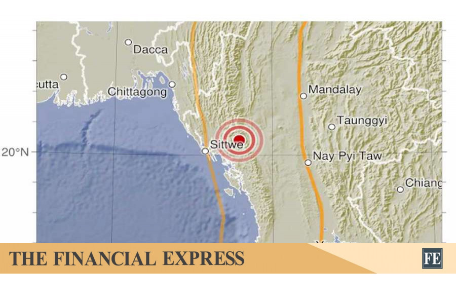
An earthquake shook Dhaka and surrounding areas at 6.15am this morning.

According to Indian Center for Seismology, the tremor had a 4.1 magnitude on Richter Scale. The epicenter of the quake was Narsingdi. USGS was yet to report on it.

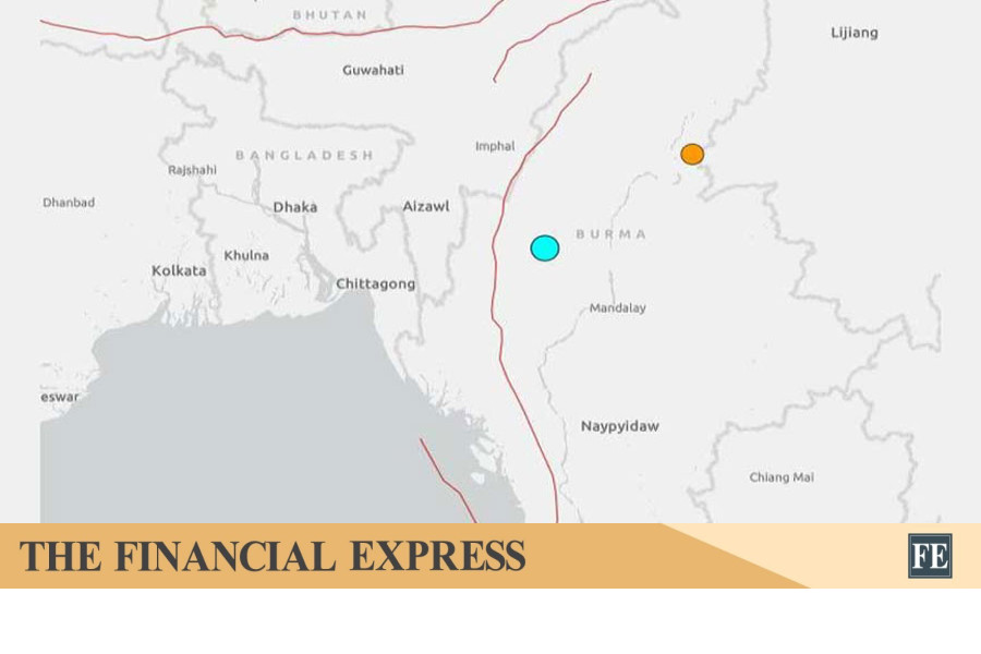
Bangladesh faces a high risk of major earthquakes due to its location along three active tectonic plate faults, experts warned recently following major tremors, stressing that preparedness, public awareness and modern technology are crucial to reducing casualties and damage.​
 
Analyze

Analyze Post

Add your ideas here:
Cite Fact Check Highlight Respond

Latest Posts

Latest Posts