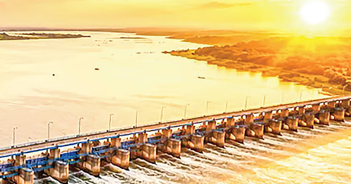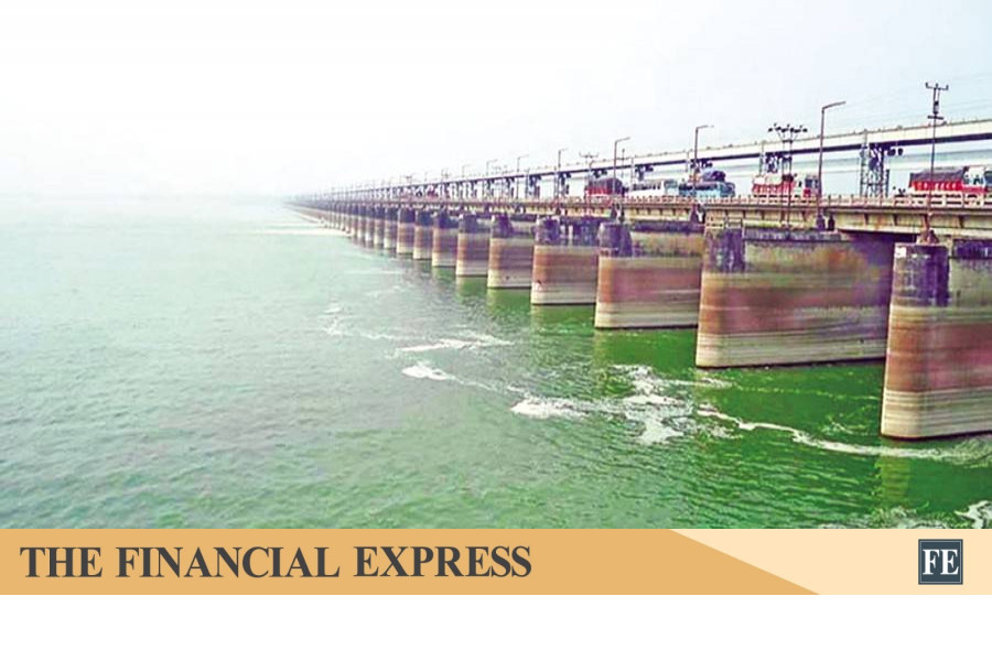
[🇧🇩] India's Water Terrorism Against Bangladesh

Afghanistan Albania Algeria Andorra Angola Antigua Austria Azerbaijan Bahamas Bahrain Bangladesh Barbados Canada China Egypt Finland Germany India Iran Israel Japan Lebanon North Macedonia Pakistan Palestine Qatar Russia Syria Turkey Ukraine United Kingdom United States Yemen
[🇧🇩] India's Water Terrorism Against Bangladesh
299
13K
More threads by Saif

G Bangladesh Defense

We are here on Bangladesh's request regarding Teesta, nothing else: Yao Wen

Diplomatic Correspondent
Dhaka
Published: 02 Jul 2026, 19: 08

1783045880099.webp

At the Chinese Embassy in Baridhara, the Chinese Ambassador Yao Wen answered journalists' questions during a press briefing. Photo: Prothom Alo

The Chinese Ambassador to Dhaka, Yao Wen, stated that in response to Dhaka's request, China has come forward with the large-scale Teesta project, which is directly linked to the lives and livelihoods in the northern region. Beyond this, China has no other concerns.

This comment was made by Ambassador Yao Wen in response to journalists' questions during a briefing at the Chinese Embassy in Baridhara, the capital, on Thursday morning.

The Chinese Embassy organized this briefing regarding the recent visit of Bangladesh's Prime Minister, Tarique Rahman, to China.

Yao Wen began by speaking on Prime Minister Tarique Rahman's visit to China.

He then answered various questions from the journalists. Highlighting the Teesta project as one of the most important topics of Prime Minister Tarique Rahman's visit, the Chinese Ambassador stated that the livelihoods of people around the river are linked to the project. At Bangladesh's request, China will provide maximum assistance for this project.

When attention was drawn to the signing of a Memorandum of Understanding with a Chinese company regarding the Teesta project, the Chinese Ambassador Yao Wen said, "The previous Memorandum of Understanding was between a Chinese company and a Bangladeshi government entity. But we are talking about cooperation at a governmental level in this project. Chinese companies can conduct their surveys. We will conduct surveys with the best scientists. If the project is to move forward, surveys are necessary. The Chinese government will work with the Bangladesh government to advance these surveys. We are committed in this regard. "

A journalist asked, regarding the Teesta, experts say India has some concerns about this, and again some say there are concerns about whether it will be effective if India does not release water from upstream.

In response, the Ambassador said, "You are talking about other elements. This is not our concern. China has come forward according to Bangladesh's expectations. "

When asked about the tri-nation economic corridor involving Bangladesh and Myanmar, Yao Wen said, "This is not a new initiative. We proposed BCIM (Bangladesh-China-India-Myanmar) 15 years ago. Although there has been some progress, it has not moved forward as China wanted. Since Bangladesh wants regional connectivity, China also wants more regional connectivity. I believe Myanmar also wants such (connectivity) cooperation."

The Chinese Ambassador further stated, "We are open-minded about other countries. If they are ready, we are prepared to include them. It depends on their decision. But China is now determined to move forward with an economic corridor involving Bangladesh and Myanmar. "

When asked about the challenges of establishing a corridor by land due to Myanmar's instability, Yao Wen said, "Initially, we can consider connectivity through ports and sea routes. "​
 

Padma (Ganges) barrage and 14 problems: Why a new study is necessary

Subail Bin Alam

1785108005747.webp

Representative image

In 2012, a comprehensive 563-page feasibility report was submitted, covering hydrology, morphology, environment, economy, social impact, and engineering design. However, the report was for the Padma of 2012, with the climate of 2012. Now, it's 2026, and the report is 14 years old. Over these 14 years, the river, climate, diplomacy, and technology have all changed. Yet, a project worth Tk 500 billion has been approved based on this outdated survey.

Problem 1: The fundamental water calculations are questionable
The report's dry season flow calculations rest on two assumptions: firstly, that the Ganges Treaty of 1996 will remain in effect, and secondly, that the flow patterns from 1997 to 2010 will continue in the future. Both assumptions have now fallen apart.

The Ganges Treaty's term will expire in December of 2026, with no indication of a new agreement. Before the Farakka Barrage, the average dry season flow at Pangsha was 2,031 cubic meters per second. Post-treaty, it dropped to 576 cubic meters, and in some years, even lower.

Without the treaty, it is likely to decrease further. Moreover, India's upstream water withdrawal is increasing every decade. The report contains no flow data from the 16 years post-2010.

Problem 2: No lessons learned from Farakka regarding silt
The report claims that if a barrage is constructed at Pangsha, the riverbed will rise only by 3.28 feet over 60 years. Farakka's real-life experience shows that the riverbed there rose by nearly 20 feet in just 52 years. Such a significant discrepancy in a similar river with similar structures implies a fundamental flaw in the modeling approach.

The Ganges carries approximately 450 million tonnes of silt annually at Pangsha. The report mentions 18 undersluices, but these sluices' total width is only one-eighth of the entire barrage length. These could quickly become blocked in a silt-rich river and, being submerged, would be difficult to clean. When to open the sluices, how much to open them, and what strategies to employ in different seasons are not covered in the report.

The silt-related mathematical modeling in the report was based on 2008 data. Significant changes in the Padma's channel, silt characteristics, and quantity have occurred between 2008 and 2026. Using an outdated model in this changed context ensures incorrect results.

Problem 3: The location issue has been closed
The Pangsha point was selected in 2012 based on the river morphology at the time. In 2017, the design was canceled due to design flaws and concerns about siltation, waterlogging, and bank erosion upstream. Nine years later, the same Pangsha point has been reapproved, but the technical solutions for the 2017 issues have not been made clear to the public.

The biggest issue is that Pangsha as the only option has never been validated through a multi-criteria analysis. Selecting any location without a comparative evaluation of multiple points based on hydraulic efficiency, silt load, land acquisition level, navigation, cost, and climate resilience is like betting billions of taka on assumptions. The Padma's course has changed significantly since 2012, with new shoals, eroded banks, and a shifted main channel. Without a new survey, it's uncertain if Pangsha is still the best point.

1785108081455.webp

Farakka barrage File photo

Problem 4: The concerns of downstream people are ignored

Downstream from Pangsha to Goalanda, there is another 20 to 23 kilometers of river. If water is held back at Pangsha, the flow in this section will decrease. With Farakka blocking upstream and Pangsha blocking downstream, the river in between is drying up. The report lacks any analysis of how this "double Farakka" situation will affect the Arial Khan, Kumar, and Gorai regions.

Since 1988, there have been practically no natural flow in the Gorai during the dry season. This has doubled salinity in the Khulna region and increased the peak salinity at Bardia Point eightfold. The project's objective is to reduce salinity, but without understanding the impact on downstream flow, it might have the opposite effect. This risk assessment is missing from the report.

Problem 5: No modern assessment of biodiversity
The report mentions two fish passes (passages for fish migration), but provides no further details. Farakka also had a fish pass, yet upstream hilsa production decreased by 92 per cent due to Farakka. Simply stating the number of fish passes does not fulfill responsibility. There is no analysis of the design type, effectiveness for different species, or how they will be managed and monitored.

Bangladesh's hilsa production has already decreased by over 71,000 tonnes in two years. The Ganges-Padma basin is a habitat for the endangered Gangetic dolphin. Gorai is the main freshwater source for the Sundarbans.

If the barrage obstructs the river's connection with floodplains during floods, it will destroy the habitat and breeding grounds of thousands of wetland-dependent species. Increased salinity in the Sundarbans will occur if downstream flow decreases during the dry season. There is no quantitative modeling of these environmental impacts in the 2012 report. Approving the project without such assessments according to 2026 international environmental standards is questionable.

1785108137299.webp

Riverbank erosion along the Padma River is swallowing up farmland in Daulatpur Upazila.Photo: Prothom Alo

Problem 6: Climate change impact is not accounted for

The report's entire hydrological analysis is based on historical data from 1965 to 2008. The rate of Himalayan glacier melt, monsoon patterns, and dry season flow characteristics were considerably different at that time.

The latest IPCC report indicates that by 2050, maximum monsoon flows in the Ganges-Brahmaputra basin will increase by 15-20 per cent.

The 100-year flood calculations in the report haven't been checked against this new reality to see if they are understated. Although there is a brief chapter on climate change, it is not reflected in the main design. Without projections of flow till 2050 and 2100, there's no way to determine how climate-resilient the barrage will be.

Problem 7: Structural safety requires reassessment

The report states that the barrage's foundation and structural design were based on a geological survey conducted in 2012. However, the riverbed of the Padma is highly dynamic, with its soil composition changing annually due to sediment deposition and erosion.

Without a new geological survey, the safety of the foundation cannot be assured. Moreover, the report does not reassess the probable maximum flood, seismic risk, or structural reliability in line with the latest standards of the International Commission on Large Dams (ICOLD). A failure of the barrage would put the lives of millions of people downstream at risk.

Problem 8: Future navigation left unexamined

The report mentions the construction of a navigation lock. However, it provides no detailed modelling of how the barrage would affect the depth of the navigation channel, water levels, or vessel movement upstream and downstream of Pangsha.

Inland waterborne trade in southwestern Bangladesh depends heavily on this river. Without assessing the barrage's impact on navigation, it is not possible to determine the appropriate size and design of the navigation lock.

Problem 9: No operational guidelines

Once constructed, a barrage will last 50 to 100 years. How it's operated will determine whether the project is beneficial or harmful. Modes for silt management at the start of the monsoon, storage post-monsoon, environmental flow in winter, emergency in extreme drought, and overflow during excess floods need to be defined. Who will make decisions, on what basis, and how the gates will function in these five different scenarios are not described in the report. Without operational guidelines, a barrage is like having a tool without the instructions for use.

Problem 10: Economic analysis only considers benefits, not risks

The report includes calculations of agricultural, irrigation, hydropower, and navigation benefits. However, there is no account of the long-term dredging costs upstream due to siltation, flood compensation, erosion damage, and environmental cost. Comprehensive investment evaluations include both benefits and risks. An evaluation showing only benefits is not an analysis but a promotion. The project's cost was originally estimated at Tk 314.14 billion in 2012. It has now exceeded Tk 500 billion. When basic costs increase by 60 per cent, benefits must be recalculated. This hasn't been done.

Problem 11: Resettlement plan is 13 years outdated

The report contains a land acquisition and resettlement plan. But the Padma's course and the habitation near its banks have significantly changed since 2012. Land that was submerged according to the old survey now has newly formed settlements, while some settlements have been lost to river erosion. Implementing a resettlement plan based on a 13-year-old survey will inevitably lead to land disputes and social conflict.

Problem 12: Funding source remains unclear

It’s still unclear if this Tk 500 billion project will be financed internally, through foreign loans, or via public-private partnerships. A memorandum of understanding was signed with China in 2013, but it hasn't been implemented. Without finalising the funding source, it's impossible to calculate loan terms, interest rates, and long-term financial burdens.

Approving construction with uncertain funding creates financial risk even before the project starts.

Problem 13: No analysis of diplomatic risks

This is the most significant omission in the 2012 report. The report assumes water will come and agreements will stand. However, constructing the Ganges Barrage could weaken or strengthen Bangladesh's position in negotiating a new Ganges treaty with India, but there's no analysis of this. There's also no mention that ratifying the 1997 UN Watercourses Convention is essential for any water-dispute-related negotiations.

Problem 14: This is a barrage project, not a basin plan

This is perhaps the most fundamental issue, talked about the least. The 2012 report is primarily an engineering feasibility study on how to build a structure. But the Padma's problems won't be solved by building a barrage alone. The water crisis, silt crisis, salinity crisis, biodiversity crisis are all interconnected and linked to the entire Ganges-Padma basin.

Unless the entire basin's water, silt, environment, navigation, and climate adaptation are inclusively planned around the barrage, the barrage may be constructed, but the underlying problems it aims to solve will persist.

Bangladesh's Delta Plan 2100 includes basin management, but there's no connection between that plan and this project. Approval was granted without assessing whether the construction of a standalone barrage would support or complicate the broader plan.

The 2012 report might have been adequate for its time, but in each of the fourteen fundamental problems, new information, realities, and questions have emerged by 2026. Technology has also changed significantly. Starting construction worth Tk 500 billion without addressing these fourteen questions or incorporating modern technology is a massive gamble on uncertainty.

70 million people in the southwest region are waiting for water. While their wait may be long, the project should genuinely benefit them. Bangladesh cannot afford another repeat of Farakka through rush construction based on old grounds.

#Subail Bin Alam is an engineer, founding member of the Centre for Science Tech and Policy Diplomacy, and Bangladesh Research Analysis and Information Network.​
 

Legal future of Bangladesh after the UNECE Water Treaty accession

Md. Fariduzzaman

1785370697834.webp


On 20 June 2025, Bangladesh acceded to the 1992 UN Convention on the Protection and Use of Transboundary Watercourses and International Lakes (UNECE Water Convention). It is pertinent to delve into the legal and diplomatic implications of the Convention for Bangladesh across internal and international fora. Notably, India and Bangladesh have experienced strained diplomatic relations over transboundary watercourse issues since Bangladesh gained independence in 1971. Discussions of possible inclusion of Chinese monetary cooperation in the Teesta water basin management further complicated the relationship between the two nations. Geographically, Bangladesh is crucial for both the Asian giants. Recent tensions in geopolitics surrounding the expiry of the Ganges Treaty in December 2026 also have profound implications in this regard.

Interestingly, in 2018, it seemed that the agreement, which was drafted in 2011 between India and Bangladesh upon the Teesta tributaries, would very soon be entered into. Unfortunately, it did not materialise arguably with claims of the then Chief Minister of West Bengal that the people in West Bengal would face dire scarcity of drinking water and water crisis in irrigation, plantation, hydroelectricity, and fishing, had the water been shared.

Bangladesh may now experience the achievements and pitfalls alongside other countries enlisted in the Water Convention. The ratio of the side-effects would intrinsically transcend the loopholes present in the bilateral underpinnings surrounding the Ganges Treaty. In my opinion, multilateralism is now a new paradigm in water diplomacy in South Asia.
Clearly, Bangladesh and India do not have identical policies in terms of water sharing and basin management concerning the largest rivers flowing through the two countries, let alone the smaller ones. On the contrary, both countries have also cooperated with each other across many axes, e.g., economy, trade, culture, and politics since 1971. Both parties, as members of the UN Convention on the Law of the Sea 1982 (UNCLOS), have also already exhibited liberal diplomatic intelligence in getting boundaries delimited in the Bay of Bengal. Indeed, the Permanent Court of Arbitration (PCA) judiciously delineated the maritime boundary between India and Bangladesh in its 2014 arbitral award. Thus, both the states had utilised rights and privileges under principles of international law.

The same mutual diplomatic bargain between Bangladesh and Myanmar also witnessed an end through maritime delimitation. After prolonged argumentation before the International Tribunal on the Law of the Sea (ITLOS), the ITLOS delivered judgement in favour of Bangladesh in 2012 and the country’s dispute with Myanmar over the St. Martin’s Island came to an end. The jurisprudential interpretation of decisions by the PCA and ITLOS strengthens the legal argument for equitable water sharing in South Asia, specifically with respect to Bangladesh, India and Myanmar.

Maritime delimitation was basically compromised to facilitate trade through sea routes and enjoyment of the natural resources under the ocean. On the other hand, mutual placement of bilateral diplomacy over transboundary rivers encircles many more overlapping issues concerning international environmental law, environmental science and geography. The Ganges, the Teesta and the Brahmaputra are indeed crucial ingredients in keeping alive water disputes between the two South Asian deltaic nations.

It is entirely possible to continue diplomatic negotiation among states on issues of trade, culture, economy, geopolitics, and even transboundary waters and oceanic delimitations. But it is in no way fair to sustain a patently unequal bargaining status quo with climate-induced aggressions compounded by the disturbances in watercourse through diversion, barrages and dams, etc. Here, nature is the only authoritarian and sovereign entity to shape the geographical peripheries of the countries.

After the possible expiry of the bilateral water treaty over the Ganges with India in December 2026, the provisions of the UNECE Water Convention would enhance multilateral bargaining over watercourses. Then international laws on watercourses may steadily guide both India and Bangladesh in the utilisation of transboundary watercourses. There are intersecting national interests of both the nations which are protected by international institutions framed under international law. India might plan to implement unilateral use of the water of the Ganges, entirely ignoring Bangladesh’s need. Now Bangladesh may have recourse to the UN agencies against such pursuit.

Bangladesh may now experience the achievements and pitfalls alongside other countries enlisted in the Water Convention. The ratio of the side-effects would intrinsically transcend the loopholes present in the bilateral underpinnings surrounding the Ganges Treaty. In my opinion, multilateralism is now a new paradigm in water diplomacy in South Asia, because otherwise, the states invariably lead a ‘country and people first’ policy. Notably, even after the formation of the democratically elected government in Bangladesh in February 2026, serious and effective discussions on the Ganges water treaty are yet to reach a considerable stage of complacency.

Bangladesh’s accession to the 1992 UNECE Water Convention should never be evaluated as a blow to the longstanding relations, diplomatic and otherwise, between Bangladesh and India. Rather, such a move needs to be viewed as an extension of Bangladesh’s search for broader international partnership in watercourse administration, jointly ventured hydropower research, and exchange of technical and scientific developments in river tributaries. Egocentrism of states in international relations and laws is never conducive because nations are encircled with uncontrollable and hegemonic uncertainties internally, regionally, and also internationally in one way or the other. To mitigate the rather uncomfortable shifts in foreign policies, Bangladesh should address the facilitation of joining the 1992 club by sharing the technicalities driven by partners in Europe and other continents in watercourse management. As such, both countries should look forward to adopting water ethics for ensuring human rights of the people of both countries along with upholding the norms of the legal provisions of international environmental laws for an equitable world.

The writer is a river-rights enthusiast and Metropolitan Magistrate, Bangladesh Judicial Service.​
 

Why India and Bangladesh need a new approach to transboundary rivers
1 August 2026, 16:27 PM

Dr Md Sarwar Hossain , Alamgir Kabir , and Sheikh Rokonuzzaman

South Asia is the region most vulnerable to climate change, according to the Sixth Assessment Report (2022) of the Intergovernmental Panel on Climate Change (IPCC). Yet this vulnerability is being compounded by a rapidly growing population, poverty, poor governance, water scarcity, and transboundary water conflicts.

After South America, South Asia is home to one of the world's largest river systems, which has shaped civilisations for millennia. These rivers not only sustain the region's culture, economy and environment, but their natural flows are also fundamental to climate resilience and ecological stability. There is no doubt that climate change is placing growing pressure on these rivers by raising temperatures, accelerating the retreat of Himalayan glaciers, and intensifying monsoon rainfall. Equally important, however, are increasing conflicts over transboundary rivers and the persistent failure to view rivers as interconnected social-ecological systems. Together, these human and climatic pressures are amplifying the adverse impacts of climate change across the region.

In broad terms, social-ecological systems describe the dynamic interactions between human societies and natural ecosystems, and the deeply interconnected relationships that determine their resilience to environmental and social shocks such as climate change and pandemics. From this perspective, a river is shaped not only by climate, hydrology, land and geography, but also by governance, institutions, economic and cultural activities, and the complex interactions among them, all of which underpin people's livelihoods. While this article does not seek to provide an exhaustive roadmap for resolving transboundary water conflicts, it highlights several key reasons why rivers must be understood through a social-ecological systems lens if we are to address the climate crisis effectively.

First, the impacts of the Farakka Barrage and the Ganges Treaty between India and Bangladesh deserve renewed attention, as they remain both significant and politically sensitive issues with profound implications for people-to-people relations between the two countries.

The Ganges Treaty is due to expire in December 2026. Signed in 1996 for a period of 30 years on the principle of equal sharing, the Treaty is conditional upon a minimum flow threshold rather than guaranteeing water flows at all times. The consequences of reduced flows caused by the Farakka Barrage are now clearly evident across the social-ecological systems of nearly half of Bangladesh. According to our recent research, the Ganges during the dry season, together with three other major rivers among Bangladesh's ten principal rivers, has already crossed the safe operating space. The impacts extend from water scarcity to the degradation of aquatic ecosystems and fish habitats, declining agricultural productivity, the deterioration of mangrove ecosystems, and increasing salinity.

1785631143017.webp

Ganges-Brahmaputra-Meghna (GBM) Basin


Once a mighty river with powerful flows, parts of the Ganges have now become so depleted that they can sometimes be crossed on foot. Known as the Padma in Bangladesh, the river was once among the country's richest fishing grounds and a major source of affordable nutrition. Although Bangladesh's fisheries sector has undergone a remarkable transformation through closed-pond aquaculture, supported by increasing production inputs, natural fish production from rivers is in steep decline as a consequence of the Farakka Barrage.

The repercussions are not confined to Bangladesh. The decline of hilsa—a fish deeply embedded in the cultural identity of millions of people in West Bengal and central to festivals such as Jamai Sasthi and Durga Puja—has also had significant consequences for India.

Though climate change has negatively affected the flow of the Ganges, we must also recognise that nearly 1,000 dams have been built across the Ganges River basin in India, significantly altering, restricting, and diverting the river's natural flow. Therefore, both future climate change projections and the diversion of upstream water through dams must be explicitly taken into account during negotiations for the renewal of the Ganges Water Treaty.

Second, the transboundary nature of rivers means that local risks inevitably extend across borders. The growing threat of water scarcity in the lower reaches of the Ganges in Bangladesh is amplifying the impacts of climate change by altering surface heating and cooling patterns. The geophysical characteristics of the vast Ganges-Brahmaputra-Meghna (GBM) river basin require sufficient upstream river flows to push back increasing salinity and sea-level rise from the Bay of Bengal. Without adequate upstream flows, one of the world's largest mangrove forests could be severely disrupted and, in the long term, irreversibly damaged, affecting not only the regional climate balance but also the Sundarbans in the Indian part of the delta.

Importantly, the Ganges in India and several major rivers in China are among the most polluted in the world, largely because of poorly managed industrial waste, untreated urban sewage, and agricultural runoff. These pollutants are carried downstream by river flows. But what happens when those flows are severely reduced by dams or by the absence of effective transboundary water-sharing agreements? Reduced flows diminish rivers' natural capacity to transport pollutants, threatening the health of downstream ecosystems, estuaries and coastal waters.

1785631179724.webp

India’s withdrawal of water during the dry season leaves the riverbed near Hardinge Bridge almost dry. File Photo: Humayun Kabir Topu

The cascading consequences of human intervention through dams on transboundary rivers are therefore felt not only beyond India's borders but also within India's own social-ecological system. According to Indian experts, flood risks in Bihar have increased significantly because of the progressive accumulation of silt upstream of the Farakka Barrage between Patna and Bhagalpur. By slowing the river, the barrage traps sediment, reduces the channel's carrying capacity, and over time creates a self-reinforcing cycle of more frequent and severe flooding. These feedback loops destabilise the river system, increasing flood risks through channel changes and altered water depths, even as further engineering interventions are introduced to mitigate those very risks.

Third, strengthening leadership in addressing climate change and transboundary water conflicts is imperative for a better and more sustainable future for the 3 billion people living across the Ganges-Brahmaputra-Meghna (GBM) river basin.

The Ganges Water Treaty, which expires in December 2026, is essential not only for rebuilding people-to-people relations between India and Bangladesh but also for addressing climate change and other transboundary river issues, including those affecting the Brahmaputra River basin. China is constructing what has been described as the world's largest dam—the "mother of all dams"—which could not only reduce river flows but also increase flood risks in both India and Bangladesh. Bangladesh and India have both announced plans to build major infrastructure projects to respond to developments on the Ganges and the Brahmaputra, respectively.

However, increasing political instability, rivalry, and countermeasures often place additional stress on social-ecological systems and may ultimately lead to social collapse in the long term. Ultimately, these pressures will increase food and water insecurity and drive migration across the Ganges-Brahmaputra-Meghna (GBM) river basin, where more than 3 billion people live in India, China and Bangladesh.

Real-time, data-driven monitoring, greater data transparency, and science-based diplomacy supported by artificial intelligence can help restore trust in resolving transboundary water conflicts and prevent severe damage to livelihoods caused by flash floods. A tax-based approach to water sharing could also be considered, whereby countries that use more water pay more, with the revenue shared among the countries within the river basin.

The solution to transboundary water challenges is neither simple nor straightforward. It requires sustained cooperation among riparian countries to ensure fair and equitable water-sharing treaties, ecological restoration, and technological innovations that maintain healthy river flows. Political leaders must urgently place human wellbeing, water security, and climate resilience at the centre of their policy agendas, ensuring that these commitments endure despite changes in governments or political regimes. The safe operating space framework for rivers could provide a robust scientific basis for monitoring and maintaining river systems within ecologically safe limits. Applying this framework across the Ganges-Brahmaputra-Meghna basin would help track the impacts of climate change, guide evidence-based policymaking, and support a more sustainable future for both India and Bangladesh.

Dr Md Sarwar Hossain is Associate Professor and Director of the Postgraduate Programme, School of Social & Environmental Sustainability, University of Glasgow. He is also Editor-in-Chief of the journal Mitigation and Adaptation Strategies for Global Change.

Alamgir Kabir is Assistant Professor in the Department of Environmental Science at Bangladesh University of Professionals.​
 

Latest Posts

Back